Trail 2 Trail
Trail Snapshot:
Trail Description
Access via the (private) 'FAA Road' to the summit is now closed for construction in the area. You can use the 'Quarry Road' to enter the area, but please don't block the road.
E-bikes NOT allowed on Trail 2
Trail 2 at Cline Butte is accessed by climbing the dirt road from Cline Falls Rd. to the summit of the buttes. You can also climb up the XC trail for a more single-track route.
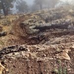
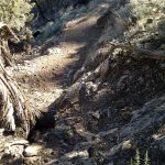
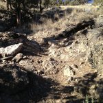
A legitimate double-black diamond, Trail 2 is best suited to a big bike and a big helmet. The trail drops down a narrow gorge to the point where it intersects Trail 1. It includes steep terrain, mandatory rock drops, technical sections, and heavy fines for failure.
At the junction with Trail 1, the main line includes a series of big doubles and dirt jumping skills are required.
Even though it’s short – pound-for-pound – it’s safe to say that Trail 2 is the heaviest DH mountain biking trail in Central Oregon.
Cline jump line video from Jim Wintermyre
This trail is maintained by Central Oregon Trail Alliance.



If this trail system officially opens up again (gate currently locked) it would be great to get some trail markers. In particular:
* Trail 2, which is a very advanced trail with multiple 6+ foot, no-avoid drops, is on the route ahead of Trail 1 (much easier way down). Because of the terrain it’s difficult to see how difficult Trail 2 is from the top.
* The XC trail relies on access roads, and other users have cut their own hiking trails or made new road areas. It made it pretty hard to stay on the trail on first attempt.
All those trails are open. The road just isn’t. You can ride the road on a bike. They just don’t want cars on it so i hear. As for signage the whole butte is full of trails that were build “unofficially” so there have never been signs. That’s going to change at some point per the master plan that’s been in process for about a decade.
Yea, a little over my ability. Walked some of the tech sections, but it was fun checking it out!