Browse The Trails
Expand Map Expand Page

Bachelor Mountain Trail
Trail Snapshot:
Trail Description
E-bikes NOT allowed on Bachelor Mountain
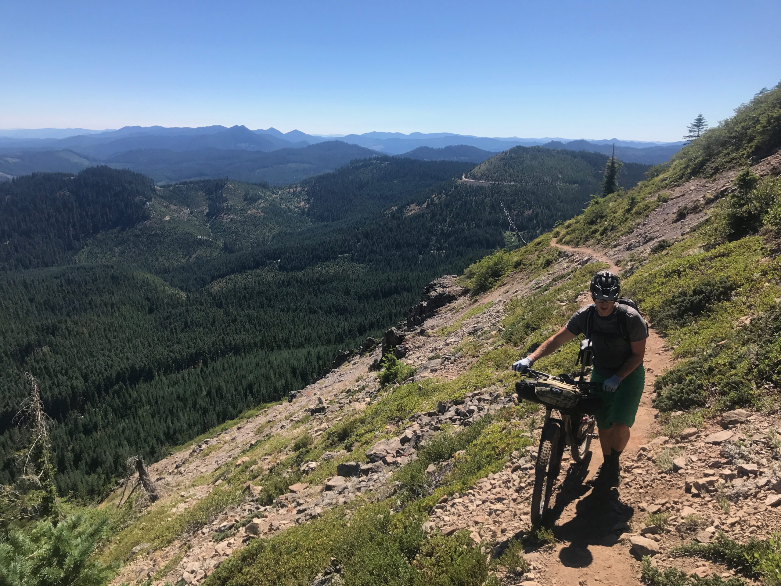
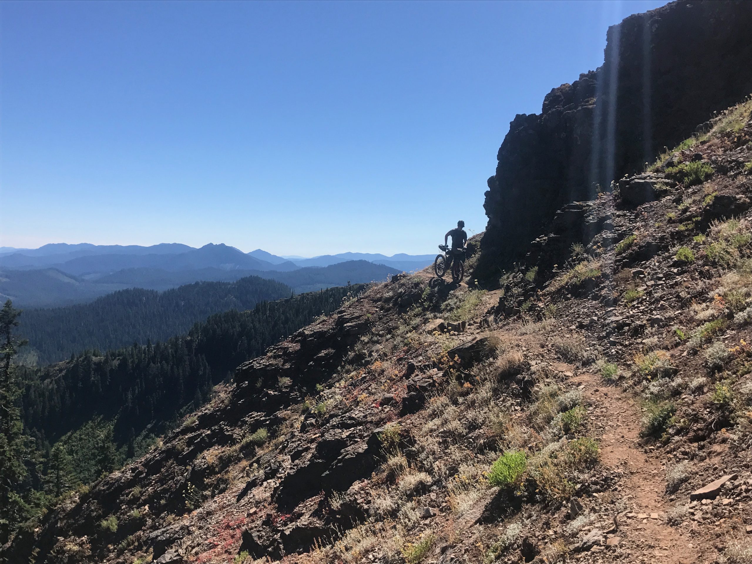
Bachelor Mountain Trail traverses (you guessed it) Bachelor Mountain. It’s not a massive mountain by any means, but it’s a difficult ridge traverse with a lot of rock and exposure. This is one of the least bike-friendly rides in the OCC area with a great 360 degree summit view. There are good views along most of the trail due to the lack of tree cover.
This trail was in the beginning a part of the Oregon Timber Trail. Yet after some OTTA pioneers rode through in the Summer of 2017 with full bike setups, they decided it was a little too much for bike packing. Bachelor Mountain connects to Bugaboo Ridge Trail about half-way up the ridge. Daniel Sharp has graciously provided the photos of the trail.
Trail Photos


CONNECT WITH BEND TRAILS
©2026 MTB Trails LLC, All Rights Reserved
A Project of Sketchbook Inc. and Delicious

Brushed and cleared of logs to the top. Thanks salamander crew!
Several trees down near the TH, but otherwise good to go. The summit descent is all clear.
Trail currently closed due to Bruler fire.
Salamander crew has now logged and brushed from the Bruno Meadows TH to the junction with Bugaboo Ridge. Trail is in good shape, huckleberries just getting started. Super view of Mt. Jefferson from rocky outcrop 1.2 miles from Bruno TH.
I thought is was Salemanders. As in our state capital. Haha
trail now Clear per Salamaders work event. Logged and brushed up to Bruno intersection. Trees are clear above this, but no brushing was done.
2 12” trees down on the short, wooded descent down to Rd 430.
Did it yesterday (5/26/18) via Bugaboo Ridge. Nice w/few blowdowns, but did clear many branches. Some patches of snow, a few in the 20-40 yard range, some sloped. Don’t be deterred – first snow gives way to dry & clear. Same with initial patch half way up the turn off to the summit. No “postholing”. Doggie water half way up.