Tyler’s Traverse Trail
Trail Snapshot:
Trail Description
E-bikes NOT allowed on Tyler’s Traverse
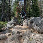
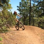
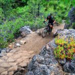
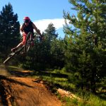
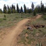
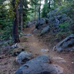
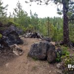
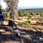
Tyler’s Traverse is a new school, one-way trail in the Wanoga trail system and is a local favorite for it’s variety of features. Tyler’s has it all! Epic views, flowy meadows, steep armored climbs, massive berms, jumps, drops, and rock outcroppings.
The trail starts at the intersection of Kiwa and Dinah Moe Humm. The first half of the trail has some great views and some significant rocky, tech sections. About a third of the way down is the “Penny Mine” which is a large rock formation with 2 short, armored climbs that are tough as hell. After this there is a nice, flowy meadow with jumps and berms which set you up for an expert option.
Many people don’t know this option exists, so they just head down Tyler’s and never know they missed anything. Note this expert line is definitively black-diamond. There is a reason the entrance is basically hidden. Not only is the entrance itself fairly daunting (up and over a large boulder pile), but soon after this you go through a small rocky channel which can send you over your bars if you aren’t ready for it. After that, there are a couple small jumps and then a fairly blind 5-6′ cliff drop.The drop has a smooth transition landing and connects back into the standard Tyler’s route shortly thereafter.
After the junction it’s more flow, berms and jumps down to the end. The trail has an up route along fire roads which starts at the bottom so you don’t have to worry about running into uphill traffic. You can also connect to Catch and Release at the bottom, the Duodenum + Larsen Trail in the middle if you want to cut across to Tiddlywinks and Storm King.
This trail is maintained by Central Oregon Trail Alliance.


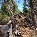


Lower section below Larsen’s junction has a USFS closure, supposedly 7 days per week but no work was being done on 6/15.
2-3 trees to climb over/under on the uphill. One tree down on the descent that could get ya if you’re not careful. I think that one was about 2/3 of the way down.
Besides the snowed in upper section most of Tyler’s is basically riding good from the top of the Lone Wolf intersection down with an exception of a couple small snow patches to go through. Took the fire road that runs parallel to it to get up to this point. Did not take the uphill route for this section. Guessing it may be a few more weeks before the upper section, climbing route & Lone Wolf are all clear of snow. Worth the rip right now from the road.
The bottom section is mostly clear.. Deep snow starts at the intersection w/ Larsens
Closed due to Fire.
Clear of trees with just a few snow patches top to bottom. Climbing trail still has snow in the middle section . Use road 4133 to access the top.
Below Larsen just a tiny bit of snow still – clear of trees.
Lower part has a couple snowbanks just below the Larsen intersection. Also a downed tree at
43.947736,-121.480738
About 5″ in diameter
Trail otherwise clear below, but has some soft corners due to recent work.
Tylers is CLOSED in both directions for forest management work. Went to go ride it yesterday and its marked off everywhere. Very sad, favorite trail in town.
Larsen’s down is good to go and riding well. Above Larsen’s, tread damage from last season’s logging, downed trees, and TONS of large debris on the trail. It’s going to be awhile before this gets cleaned up.
2 trees cleared off down route just above road crossing. Saw some snow just past that but just a patch. Thanks for the help matt
Uphill route still has a lot of snow.
Deep snow persists in the lowest section. Looking forward to some thaw this week.
Clear of snow. Tacky. A few larger branches on the nearly flat on trail midway down.
Tyler’s uphill is now compacted and riding well uphill : )
Uphill Tylers, from Afternoon Delight to Tylers/Larsen’s junction, has been worked on by heavy equipment and graded into a soft deep sand pile from the bottom to where the downhill TT crosses uphill TT about half way between the bottom and Larsen’s. Very difficult climb in deep sand, very high rolling resistance. Road work has also knocked down trees onto the downhill trail just after Larsen’s. Downhill riding great! Uphill a total slog.
Apparently 2 trees down actually say a new report on top of Tyler’s. And today a bear spotted up there. Sweet!
Tyler’s is good to go! No snow and no down trees. Up route has a few small patches of snow still.
Rode on May 17 from Duodenum down. Several snow drifts between Duodenum and Larsen’s still, with some rutting and water running down the trail – best to avoid that section for a bit longer. Below Larsen’s, trail is snow free an in great condition. No deadfall from Duodenum down.
Double trees down about 14” and 10” a half mile below the duodenum intersection. Some snow patches but otherwise very rideable below duodenum.
Pretty decent amount of snow above Larsen on climbing route and A few trees down. Largest maybe 10”. Ride Royal flush down which was off the charts
Bottom-most part “Tyler’s Last Chance” is good, above that it turns into snow patches. Lots of pine cones.
I cut all of the trees except one on the lower part below Larsen. Quite a bit of snow but still fun.
All trees are cut on Larsen’s and lowere Tylers. There is still snow.
A double tree (8”,5”) and a 10” tree down on upper tylers climbing route.
Tyler’s is clear now.
Tyler’s is too wet to ride as of Thursday 10/28 afternoon. If there are puddles on the up route, that’s a good sign that it’s probably too wet to be riding. I pedaled up to the Larsens junction and walked into the woods to get a read on the singletrack conditions. Within 30ft I saw a mud bog full of tire ruts, so I turned around and took the forest road back down.
If you’re choosing to ride a trail in these conditions please consider donating your time and/or money to COTA and the Forest Service.
This may be too late but there are three downed trees in the upper section. Two are on the up route just before the junction with Kiwa and the third is in the first rocky climb in the upper section.
Lost a pair of smith glasses with pink lenses today (June 2nd). Information leading to their return will be rewarded with drink of choice. Please email me at my firstname.lastname@gmail Thanks!
Rode from the larsens junction down to rd 41. The upper have has LOTS of standing water and puddles. Lower half is riding great after last nights rain.
All good from the tippy top! let er rip!
Rode the up trail tonight until I hit hike a bike snow well above duodenum after lone wolf heads off up hill. Cross country to join lone wolf on the way back down. No trees on up route to that point. One tree on down route a Little below duodenum. I sawed it into sections and moved it off trail as best I could solo.
word on the trails is a couple trees on down route above larsen. Snow patches near the top. Up route still trees down.
Right below the Larsen’s junction a few patches of snow. Otherwise clear going down to the trailhead.
From the bottom you could do laps at the first trail crossing but if you go any higher than that there is unrideable snow patches and mud puddles.
2 feet of snow at the Tyler’s/Larsen intersection. Prepare for another mile of hike a bike before the snow stops and suddenly the trail is back to dry and dusty. If you like adventure get out there. If you would rather actually ride your bike, best to wait a few more weeks.
Anyone know the reason for the “NO X” signs at the top of Tylers and at the intersection of Kiwa and Tiddlywinks? At the top of Tylers pink signs with arrows pointed back down Kiwa toward the Kiwa and Tiddly intersection, then back down Tiddly toward Wanoga.
Those are signs for the HighCascades100 race which will happen on the 18th. Mudslinger Events always removes all the signage after the race.
Clear top to bottom. Good shape near the top, turning to dust near the bottom where a few of the corners are eroding away.
Clear top to bottom, no trees or snow. Some serious hero dirt out there right now
Facebook Group Report: Upper Tyler’s has snow and deadfall, lower Tyler’s a couple snow patches and one tree.
No trees down below the Larsen’s junction. Getting really dry and dusted down low where they harvested the trees.
Clear and riding perfectly below Larsen’s.
Found a Jeep key fob with a Thule key today at the Tyler’s parking area. It’s sitting on the sign post for catch and release next to where Tyler’s dumps out.
Lost a pair of black Kitsbow gloves at the trailhead for the climbing route yesterday. If anyone found them please let me know. Brandon – 818-606-7542
Other than that the trail was riding well. The flow section through the trees was still super fast, rest of the trail had lots of brake bumps though.
Tree accross climbing route has been cleared. Others still there should stay and have been there a while as they have very nice, developed go-arounds. Dirt was magical today
Dead deer on last leg of uphill. You will smell it before you see it. Couldn’t tell what killed it. Also additional tree across uphill climb past the bottom of Lone Wolf.
Rode Tiddly, Kiwa, Tyler’s today. Few snow patches on first section of Tiddly, not of much concern. Kiwa had a few more snow patches, again, little concern, but so worth the reward: Tyler’s…OMG!! my best run ever! Clear, with sweet Hero dirt tread.
Up route cleared with the exception of one larger tree. Thanks Brian Coop!
Still a large tree on the up route above Larsen’s. Ride around established.
Up-route has a few trees and a couple of patches of snow. Tyler’s Traverse tread is perfect with a few braking bumps here and there.
Rode up from the trailhead to the rock step intersection. Uphill from Duodenum still has large snow patches and several downed trees. You can make it up but likely no Strava KOMs will be broken. From the intersection down there is just one large snow patch remaining before the rock steps and is otherwise clear.
Thanks to everyone who has been clearing trails this spring!
Finally finished removing downfall off uphill and downhill trails from Tyler’s to Larsen’s.
A few snow pathes near the very top, but not many. Should melt off quickly with the warmer temps.
Thank you,
Cleared 5 trees off trail from 1st road to second road crossing. A few snow patches. Shoveled channels thru the deeper areas so all snow areas are rideable.
I should clarify that the 2nd road crossing is FSR 050. Still plenty of large snow patches and downed trees from 050 to Larsen’s.
Removed all down trees from trailhead to first road crossing. Trail is dry and in good shape on this section.
Still lots of snow below the first road crossing. That section might be ready in 4-5 days though. 2 small trees down below the lookout and one larger a bit past that.
Great from Larsen’s down. There were no tracks above the junction so I’d guess it’s deep snow up higher. Several trees down.
Top half is under snow, and lower Tylers is muddy.
Down route is clear. Still a couple on the up route. First is a big leaner (14″) below Larsen’s which has a good ride around in place so I didn’t bother with it. Second is past Duodenum. 17″, dense, and leaned up on the bank. Cut one side of it to make it a little easier to climb over but decided to not go for cut #2 since I needed to save some sawing strength for the down route.
Couple trees down. A big one (12″) before the armored rocky climb and a small one (6″) before the Larsen’s junction. The second one comes up on you quick without a lot of warning. A third small one down on the ground (6″) after Larsen’s and before the last road crossing.
All clear! The big one was 14″ by the way…at least it was rotted out so the sawing wasn’t too rough :)
The rock drop alternate line is closed for trail work and the regular line has been rerouted for the same. I’m guessing that it’ll probably be that way until spring — but that’s just a guess… From the look of it, it’s gonna be awesome once it’s bedded in.
Just in case anyone reads this comment the alt drop line is officially open (Lone Wolf) and even had signage!! Still kind of easy to miss it if you don’t know where to look.
Is the up route from the bottom to Larsen any better since there has been some rain?
Much better. We rode it on Monday afternoon and the ground was firm. Get some!
We need rain! I rode the downhill section today – from Larsen and it was pretty choppy. Super fun, but really sandy.
Tree down across lower Tyler’s as of yesterday evening.
have a size and approx location? Thanks!
If it’s the same one reported on the FB group (up route) I just cleared it.
be advised lower tyler’s up route is deep sand due to all the logging. Gets better close to larsen.
You’re not kidding! I almost turned back thinking it must still be closed.
Rain can’t come soon enough.
Didn’t I see an announcement from COTA back on the 12th saying logging was finished and Lower Tyler’s was open again?
Is it really closed again?
Thanks
Nope. It’s open… will take down that message about the closure now… thanks.
Thanks!
Thanks Nat!
We are visiting the area in August and we are looking at riding this trail. We have a trail map. “On the map” we have it shows a singletrack downhill, and a doubletrack/jeep road for uphill for this course.
Is that correct? We want to be sure since the trails are one way.
Not being from the area, is the trail well marked at start and stop, and along the way?
Best way to access the trail?
Thanks much, we are from out of state!
Correct, Tyler’s has a separate uphill route that’s mostly two-track. If you were to start at the bottom off of Conklin Road you will see a marked uphill route.There are a couple of forks in the jeep road on the way up on which the markings could be better (one of the arrows is tucked into some tree branches and is easy to miss) but mostly the trail is easy to follow. You’ll likely be able to discern obvious tire tracks on the ground so try to go where it looks like most people have gone. Find your location using your phone by clicking “Map” on this website’s homepage if you’re not sure which fork to take.
Edit:
1. Three are several posted trail signs at the critical junctions, so look for those.
2. Click “View Map” on your phone.
Saturday ride was great; top of Tyler’s was awesome, blooming wildflowers, trail in great shape, and lots of green…..but the logging has chewed up a bit of the lower trail area and it’s quickly becoming dusty as the sun beats down on the trail where the trees no longer shade. Everything looks different, of course, as they rip out brush and trees, but you can still easily find the trail……so far. Probably not rideable during the week while they chop and drag!
Lower tyler’s is closed for logging for a couple weeks.
parking on colklin will be closed 6-7-18
There’s one 8″ tree about 200′ from the Kiwa Butte junction. Easy to step over. Also, no snow patch below the rock drop in case you want to huck it without looking :-)
Confirmed clear landing below the drop… definitely eased up to it a little slowly in case of snow. Sad that someone has already managed to destroy every berm on the way down. Otherwise hero dirt.
Tyler’s is 100% clear from where the uphill trail intersects the downhill trail at about 5300 ft. I cut the tree just before the rock pile climb on 4/29. On the uphill there are two short hike a bikes through some snow. It’s riding quite well. No snow, no mud on the downhill.
Thanks Don!
Sweet! Thanks for getting those.
4 trees down between Larsen’s and the rock drop. – 2 between Larsen’s and next road intersection. 1 just above that, then final was pretty close to the rock drop. Didn’t go any higher than that.
Below Larsen’s there were 6 trees down on Tyler’s Up route, 0 on Down. Starts to get muddy right at the Larsen’s intersection.
Deadfall cleared from Larsen’s to the bottom.
Wow thanks so much. A couple of those were doozies!
I second that, thanx Clarence!
The first half mile of lower Tylers has patches of melting snow/ice with some standing water. Once the downhill starts it it pretty much hero dirt although there are 3-4 big trees down including the first one right at the Larsens intersection (all before the lookout view spot). Will def need a chainsaw as some have lots of limbs. Thanks much to all you tree cutter outers btw :) Upper Tylers still has snow from the Larsens intersection up and the road climb up appears still muddy, rutted with patchy snow in places.
I tried to ride Tyler’s last chance today (from the first road/trail junction down). Super muddy in several spots and one big tree down just below the road crossing. Probably needs at least another week of warm weather before the bottom is ridable. The upper part, who knows? It’s really wet and there are still snow patches melting into the trail.
Sweet! About 3 or 4 trees down below Larsen’s.
Both lower and upper were very fat bike friendly up to the Duodenum intersection (1-2″ snow). Past that it gets deeper (3-4″) and I eventually turned around when I started hiking more than biking. Cleared deadfall up to Duodenum except for a 15-18″ fella on the uproute maybe 0.5-1 mile from bottom. There was a solid ride around option already in place.
1 inch of snow and 2 trees down on the lower section. Smoother at times on my no suspension fatbike than in the summer.
I climbed the road on the south side of Tyler’s (keeping left at Duodenum junction) on my fat bike on Sunday. The very top of Tyler’s had 3-6″ of snow with some ruts and post-holes in it but it was all rideable — a non-fat bike “might” be able to make it, but you’d probably have to hike through the thick stuff.
Get your inversion on: today it was warm – complete with some mud puddles – at the top of the trail, with colder snow further down. All very rideable though, except for the last part of the climb, where the snow started to get a bit deeper.
We rode Larson’s to Tyler’s then down last night. One tree you have to crawl under just past the Larson’s junction. Maybe 8″ diameter. A few snow patches, but otherwise, great dirt.
Had a couple other riders with me today, so we moved that tree out of the way. Riding great from Larson’s junction down — with snow above that.
Rode it this morning in really great condition. No snow. No mud. One tree was down across the road on the way up, but otherwise it was obstacle free.
Dirt was great yesterday. Rock Drop still has some snow in the landing.
Four trees down directly below the Larsen’s intersection. They’re all off the ground 3-4 feet, so they are difficult to climb over. After that it’s all clear. I didn’t go any higher, so not sure what it looks like up there.
Cleared those this morning with Gary. Didn’t clear the up route as I had to head out.
Some trees down on Climbing route per FB report
It’s all good from the Rock Drop down, but you can’t climb that high on the Uproute. Going up it got too snowy in areas without tree cover above Larsen’, so I pushed through the woods over to the DH trail (I don’t recommend that), but it was nice to see that the trail had minimal snow from that point down.
There’s a blind drop into a worn groove that’s tricky on the lower trail. It’s below the viewpoint and after the big jumps.
Good ride on Storm King / Larsens / Tylers / Catch and Release with dog with AM; ran into a bow hunter at the intersection of Larsen and Tylers. Notched and ready to fire – said there were elk in the area. Was not much interested in running into either him or the elk. Do not pay much attention to hunting season – was he supposed to be there?
Hunting is allowed in the area yes. Luckily no problems other than the time someone gutted a dear on upper storming and left the carcas laying there.
There’s a gnarly tree across the DH trail just before you get to the Larsen’s junction. It’s only about 8″ thick, but has nasty impalers sticking out of it and it’s around a blind-corner so you come up on it fast — so heads-up.
3 miles from start of Uphill route, you will encounter big nasty fallen tree. It is right before Duodenum trailhead.
Had a great time today on Tyler’s. Went all the way up Kiwa. Some turns have some sand, but nothing too much too just slide through. Only saw one other biker (at the trailhead). It’s a grind up, but worth it on the way down.
Saw zero moths today. Weird. Also saw zero other bikers on a Sunday afternoon. Also weird. Tyler’s is dry and dusty, but it could be worse. Still super fun!
Plague of little caterpillars on Upper Tyler’s tonight. 20% are now smooshed and stuck to my frame. Gross.
Yeah it was a massacre out there, it was the same on Mrazek in the burn section with the snowbrush.
Tyler’s is getting kinda loose in the corners and those braking bumps are making a comeback. It’s still riding great — just not “last week” great.
Rode all the way up to Kiwa today and then down Tylers. There was no snow on the bike trail except for a very small patch around the Kiwa intersection. The downhill trail is in great shape with no snow the entire way down or fallen trees. The little expert loop option drop landing is a bit loose but all in all great riding. I’ll be hitting this for the next several rides!
We were able to ride all the way up with only a few snow patches. We didn’t ride all the way to the duodenum intersection. We stopped where the trail first crosses the uphill route. Some corners are already getting a little dusty but overall… Fantastic!!
Solid riding from Larsen intersection on down.
Don’t think it’s been updated but people have been riding a lot higher too. Up to the road crossing above the meadow and rock armored sections if not higher.
Still snow drifts between the Duodenum junction and the Larson’s junction.
Snow and an impressive tangle of downed trees right at the Larsen’s/Lower Tyler’s junction, and then one more downed tree and a snow drift just as you start down lower Tyler’s, but then it opens up into shredtastic radness all the way down to the road.
Road it from Larsen’s down to rd 41 this morning, ditto your comments exactly! Tangle of trees, couple patches of snow, and definitely “shredtastic radness” from there! :-)
As of last night around 5:30 the tangle of trees had been cleared. One large tree below that, but it’s easily rolled over. Maybe three snow piles to ride through. Up Tyler’s from Larson’s appeared to have really deep snow — so didn’t try to go any higher than the junction.
I rode up to the intersection with Larsens yesterday.
There are a number of hike-a-bike snow drifts in the last half mile, and there’s a tree down on the uphill route.
On the downhill trail, the first 1/4 mile has 30″ deep snow drifts. Then there are patchy drifts until a couple hundred yards before the last forest service road crossing.
At this point only the lower section is worth riding.
Only the lower section, below the last forest service road crossing, is free of snow. Above that there is still lots of snow on the trail and forest service roads. I found out the hard way. Lower section rides well like it did in October. Could use some work on the brake bumps. Great trail.
The climb has several snow patches that will require a short hike bike but you can descend down where the trail crosses the road with only a couple small snow patches. From the view point down the trail is clear.
Heavy snowfields. Riding even the lowest section will mean lots of hiking and trudging through snow. We’ve still got a long while before this is good to go.
Uphill Route has single tree down. It is located 3.6 miles from bottom. Otherwise, 16-mile loop via Kiwa, Tiddly, Larsen’s, and down Tyler’s is riding well – there are puddles, but not too bad.
Lower Tylers from Larsen’s intersection is perfect tacky tread. Based on the snow/slush at the Kiwa Butte/Tiddly intersection today, I suspect upper Tylers is snowy??? Report needed…
Rode Tyler’s last night. Super blown-out and dusty with lots of braking bumps. Still fun though ;-)
As of Friday (22 July): Lower Tylers (below Larsens) was pretty blown out and dusty… Need some rain on this one soon.
Upper section of uproute is still a little torn up and bumpy from equestrians trampling it after the rain we had a couple weeks ago. Getting better, but still a pain to deal with when they shouldn’t have been there in the first place. Maybe better signage?
Hi Mike, good question. It’s an uproute on a fire road, and as such might not be classified as a trail horses are not allowed to be on. I will try and find an answer, but my guess is your won’t be able to keep horse off fire roads.
COTA answer: Roads are open to all.
I thought that could be the case as well, but I suppose there could be some room for interpretation on the sections where it is overgrown to a narrow passage. Still technically on a road bed though. Just a little bit of a bummer seeing it getting trampled. Thank you for getting that info to clear it up though!
luckily it’s probably pretty uncommon. I have never seen a horse in wanoga. Makes me wonder if the uproute signage has the stickers for no horses, etc (accidentally).
Blown out. Sigh……rain please.
Pretty much awesome today. Drying out quick. Give ‘er.
Riding great. Starting to get a bit loose in a few spots, but most of the berms are still nice and firm.
Also in my desire to not stop once going down I noticed a few trees which are not directly in the way, but if you weren’t paying attention you could lose your head. I would say 2-3 leaning trees which need to be cut. None appeared all that big.
Cleared a couple smaller trees on upper Tyler’s. I think there are just 2 medium sized one’s left which are right beside each other.
Above the intersection with the upwards route (and closer to kiwa) there’s several downed trees that you need to climb over. Below that intersection, its wonderful all the way down, if a bit dry.
Lower Tyler is riding like a boss – upper Tyler is cover in 5 feet of snow!!!
Tyler’s Uphill route has 2 sections with deadfall, but going around each is pretty simple.
No snow below Larsen today.
No trees below the Larsen intersection, but a couple short patches of snow still. Overall riding really well below this.
There’s a big tree across the trail just before you get to the Kiwa Sprs Rd. Snow disappears below the 100 road crossing.
Lower portion of Tyler’s (Kiwa Springs Rd to Rd 41) is clear of trees. Still small sections of snow interspersed throughout.
Blowdown still gets overwhelming around 4700ft. Snow doesn’t look to bad further on, but trees make riding tough.
Trail cleared of blowdown up to ~4700 ft. Still lots of snow above this elevation.
Thanks Justin
We survived a 5+ hour Storm King/Tiddly/Larsen’s/Tylers/Catch & Release loop today. SK up to Tiddly was mostly hero dirt with a few creek crossings and patches of hike a bike near the Tiddly intersection. Tiddly was the same up to Larsens. Larsens started out rideable but quickly the snow deepened to where we were losing the trail and postholing/pushing through 2+ feet of snow at times. Lots of trees down too so good upper body workout. Somehow we managed to pop out on the road at Kiwa Springs and found Tylers under snow as well. After more miles of pushing our bikes DOWN the Tylers climbing road (lots of snow and trees down here too) we were rewarded with a downhill on the last 2ish miles of Tylers – snowfree and perfectly buff along with a hootin’ hollerin’ fun return down Catch and Release back to our cars. Gonna be a while till Larsen/Tyler melts and trees are cut out. Fun time regardless – I’m beat!
Couldn’t even reach the 1st road climb junction with Tyler’s before it turned into post-hole hike-a-bike. Lower Storm King was similar. Didn’t get far on that one either.