La Pine State Park Trail
Trail Snapshot:
Trail Description
E-bikes allowed on La Pine State Park
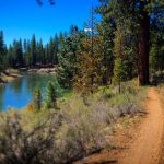
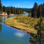
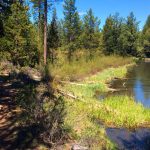
About 30 minutes south of Bend, Oregon the La Pine State Park trails meander along the banks of the Deschutes and Fall Rivers for approximately 11 miles with many MTB loop options which can shorten or extend your ride. The terrain is mostly level with no real climbs or technical challenges making this a great ride for families or novice mountain bikers who want to get out on the trails — but don’t have a lot of experience.
The trails are well-signed and maintained with markers at each junction and are multi-use so you’ll likely encounter horses, hikers, other mountain bikers, or a group of Llamas (one of the weirdest things I’ve ever come across on BendTrails).
Mostly single track, with a few old double track sections, these trails are typical Central Oregon sand, so they’ll be very soft and loose in the summer months.
One of the cool things about La Pine State Park are the gigantic old-growth Ponderosa and Lodgepole pines. A highlight of the Big Pine Loop is a massive tree named “Big Red” that’s over 500 years old and 27′ in in circumference (you can’t miss it). Big Pine is now mostly paved and there is a new parking lot we have yet to visit.
For information about the park or camping opportunities, visit the official Oregon State Parks webpage.




Mud, snow, ice and a few downed trees. Saw a couple of narrow tire tracks but it looks like they were having trouble. It would be tough going even on a fat bike.
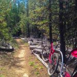
Lots of trees down on the Fall River loop and McGregor loop, including a giant 3’ ponderosa. Looks like people are creating ride arounds on some. Interesting that the state park doesn’t clear these? No funds?
Typical summer conditions, sandy and loose, but clear of trees.
Double digit deadfall on the Fall River Loop from the storm this past week. McGregor Loop also compromised d/t deadfall
Note: The Big Pine Loop trail in whole or in part is now paved. In addition, a new parking area has been installed near the Big Pine Loop trailhead.
Thanks for the info. We will change description
There is a paved spur trail from the parking lot to the Big Pine, but the dirt “Big Pine” (Park has it as Big Tree) Loop still exists. Going west from the Big Pine isn’t marked and the track is narrow in the grass by the river. There is deadfall as you approach the slough, but not bad if you to walk around. There’s a map here: https://www.mobilemaplets.com/showplace/9259
Now I see in the map legend, it is Big Pine Loop.
Rode Cougar Woods, Big Pine and Deschutes loops yesterday. Cougar Woods was more of a cyclocross experience, lots of downed trees across the trail. Otherwise great conditions.
I noodled around Cougar Woods and Big Pine and had no issues whatsoever yesterday. It inspired me to ride up to Paulina today to see how far I can get without committing ecoterrorism……report to come
Can’t wait to hear about Newberry. Plan to help log it out once it’s ready.
Hiked this yesterday. Mud puddles, water puddles, packed snow and ice. No bueno!
Trails on the west side of the river were well travelled and hard packed, but a bit choppy from foot travel. Trails east of the river had less tracking, except for a big kitty cat on the appropriately named Cougar Woods Loop!!
As of this morning I cleared the last of the downed trees on the trails. The trails are 85%- 90% dry as of today still some spots of freeze/thaw but good from Fall River to Lapine state park.
Trails look to be in good condition. No Llamas sighted.
Took a break from Portland and was hoping to ride this today with my 9 y.o. Too much snow to get further that a few feet into the trail.
We family-camped at LaPine S.P. two weekends ago and rode these trails for the first time. We pulled our 2 kids behind in WeeHoo’s (kind of like trail-a-bikes but with bucket seats) and had a blast. I’m an advanced rider but really enjoyed these trails.
There are 3 somewhat steep but short climbs (for beginners and hauling a kid in a WeeHoo), otherwise the trails were level and smooth, with some really twisty bits closer to the Fall River end.
A great place to take beginners, family, or just to go for a mellow, scenic ride. :-)