From Beta Explorations to 75 Miles of New Singletrack!
I am constantly scanning the landscape for trails, envisioning potential trails, or just day dreaming about what trails might lie just outside of view. This happens every time I drive the Santiam highway from Sisters to Salem. So much endless potential with the terrain but not a single trail to ride. Well that’s all about to change!
Surely you have seen me post about the Cascade Crest over the last year and a half. It’s been a project near and dear to my heart since seeking out these trails in the fall of 2016. Several people have written about the area, and I will include those links in the next few blog posts.
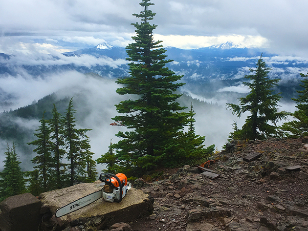
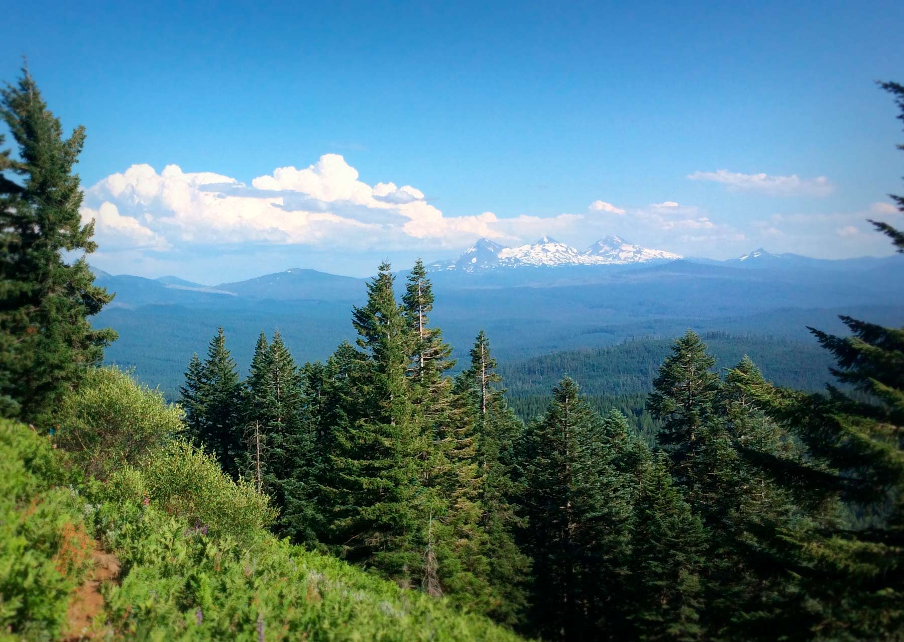
View off Crescent Mountain Summit
First off – Where are these Trails?
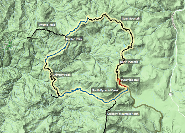
There is a 30 mile (8k elevation, or more) loop in the Old Cascade Crest (OCC) which resides 30-45 minutes to the west of sisters near the Hwy 20/126 cutoff. It’s been dubbed the Pyramid Epic Loop due to the dramatic 3 Pyramids which are the highlight of this loop.
The loop is made up of 6 trails: Pyramids, South Pyramid Creek, Chimney Peak, Gordan Peak, Scar Mountain and North Pyramid. It’s a spectacular zone within the Cascades with its own special character and charm. Remote, steep, and primitive with craggy peaks and views for days.
Connected to the NW edge of the loop is Swamp Peak trail which runs for a few miles before entering wilderness where bikes are prohibited. A couple miles to the North of the Loop there is Bugaboo Ridge, Bachelor Mountain, Bruno Meadows, and Coffin Lookout. Some burly trails! There’s also the recently DE-commissioned Coffin Mountain trail. We are hoping to get this re-opened with the blessing of the USFS.
Connected to the Loop to the South is the stunning Crescent Mountain Trail South and Crescent Mountain Trail North. These are actually one trail, but we have split it into 2 segments for ease of updating.
A few miles to the South of Crescent Mountain there’s Gate Creek, Browder Ridge and Heart Lake which reside to the South of Hwy 20 and West of Clear Lake. These trails are very close to the start of the McKenzie River Trail. As such, they also listed within the McKenzie region. Gate Creek has become one of my favorite trails for the downhill fun you can have.
A couple miles to the West of Browder Ridge, you will find some techy, remote goodness in the likes of Gordan Lakes & Gordan Meadows. Recently DE-commissioned Soapgrass Mountain and Weiderman trails both connect to Gordan Lakes, and we are hoping to get these re-opened if they look promising. Weiderman trail descends 3400 ft in 3 miles!
All in all, it’s over 75 miles of trail you can ride this summer.

One of the signs off highway 22.
First Exploration Ride.
There are signs posted along both highway 22 and 20 that say “Old Cascade Crest Trails” and I have wondered for years what they meant. What did they mean by “Old”? Well, it doesn’t really matter – it lured me in! I assumed at the time they were trails built and used prior to the Pacific Crest Trail, but I don’t believe that is accurate.
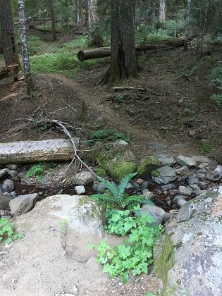
Pyramid Trail head. Step on in!
I finally decided to check it out on my way back from Salem in mid-September 2016. I turned at one of the signs and proceeded to drive on paved and well-maintained gravel roads until I came to the unassuming Pyramid Trailhead. There are a few signs helping to guide the way. As with most trails in this area – the TH was completely undeveloped. There was a trail sign, but that’s it. I parked and got out to inspect the trail. Immediately, 2 ft off the roadway, the trail went directly down into and across a small creek. Not very inviting, But I dig that!
A large log which had a crosshatch pattern was laying off to the side – and at some point, it had been a bridge. I hopped over a couple rocks and onto the main tread. It was early evening and this trailhead is at the bottom of some East facing terrain so it was fairly dark underneath this old-growth canopy. I was immediately struck by the solid, well constructed tread which lay dormant under this massive canopy of old growth monsters. What an amazing place. Years of branches, sticks, pine cones and deadfall littered the trail. Note the photo to the left is a more recent image.
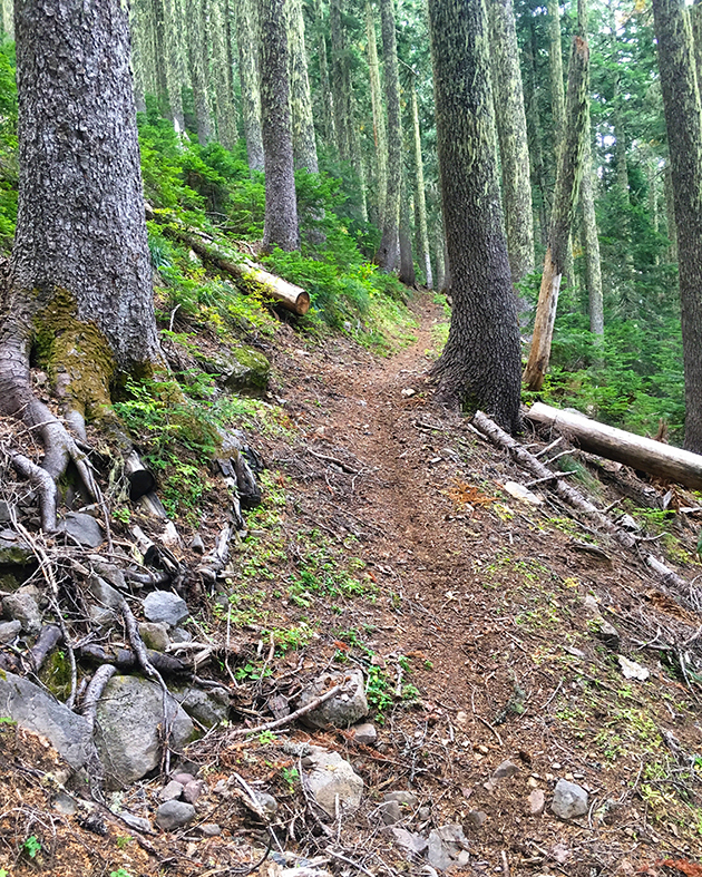
Gorgeous tread on Upper S Pyramid.
I didn’t have a bike with me, so I just looked around a little. Once home I started looking up trails in the area. Pyramids, North Pyramid, South Pyramid Creek, Scar Mountain, Gordan Peak, Crescent Mountain, and the list goes on. After more digging, I came across a website called “The Dirt Magnet”. Why had I never seen this site before? The Dirt Magnet (TDM) was a talented writer with great trail summaries, ratings and amazing photos. It appeared that he was one of the very few people to set a bike tire to these trails. Some trails like Scar Mountain appeared to be painfully overgrown per TDM’s write-up. I have since learned that COTA once had a board meeting on top of Crescent Mountain. My kind of meeting!
I soon contacted TDM who turned out to be Eric Brown from Corvallis. Eric is an avid adventure biker and very into the outdoors. I started asking him questions about the trails. Were they legal to ride? How often were they cleared and so on. After giving me the lowdown I told him clearing these trails would be a goal of mine as soon as I could get certified on the chainsaw. Eric was eager to help in any way.
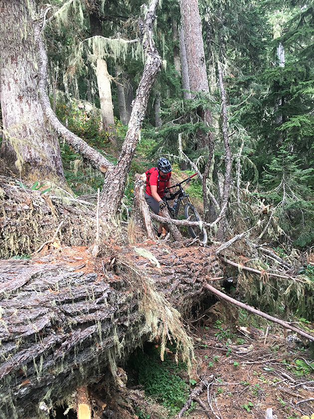
Steve crossing over a biggy
I ended up talking my buddy Steve into doing a little test ride out there in mid-September and we parked a car at Crescent Mountain South, and drove the second car to the Pyramids Trailhead. The plan was to ride down South Pyramid Creek trail to the intersection of Crescent Mountain North and ride up and over Crescent. The day went according to plan. I was totally expecting it to be a course in down trees and bush-whacking (my favorite kind of adventure), and that’s how the day went.
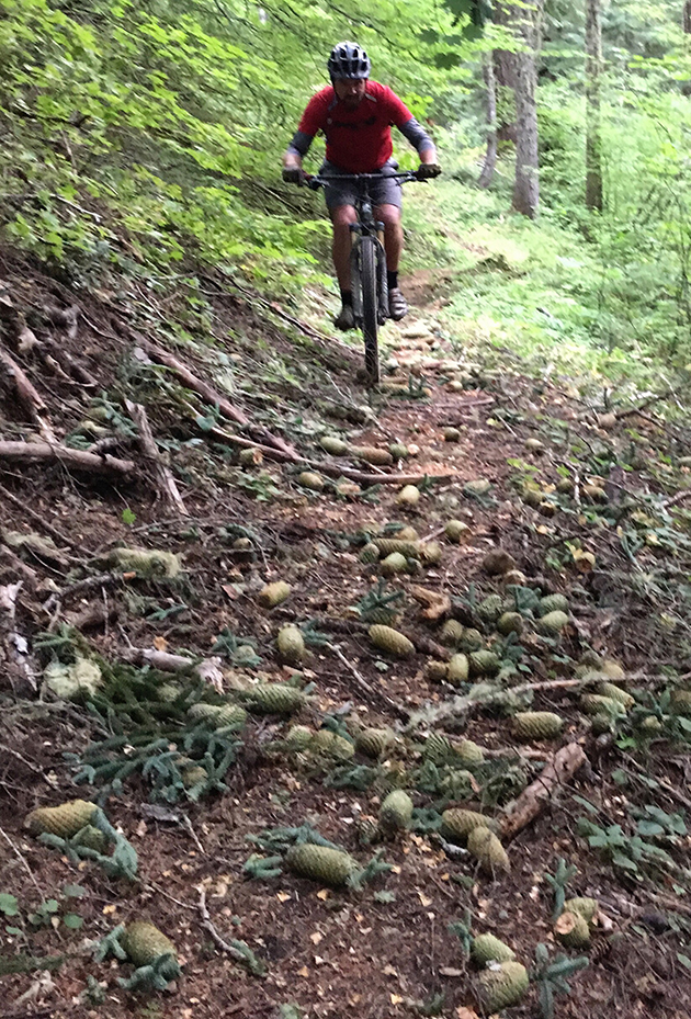
Rake me!
The trails were sweet! Raw, scenic and primitive. I later found out there were built by the Civilian Conservation Corps (CCC) about 80 years ago. Other than some water damage in sections and overgrowth in others, the tread was in great shape. I would guess we crossed over maybe 60 trees on the 15 or so mile ride. We made it to the 572 road, where the South Pyramid Creek Trail continues to the West or across the road you can jump onto the Crescent Mountain North.
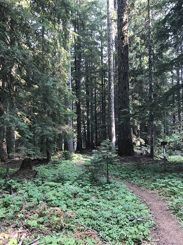
Start of North Crescent.
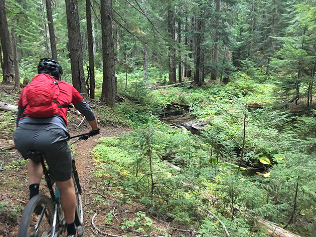
100 Yards from the start of N Crescent. Creek crossing armored with Rock.
We proceeded to Crescent Mountain North and soon after entering into the forest canopy we crossed a lovely rock creek crossing over Ford Creek. After this, the climb began in earnest with sustained 30% grades at times. Everything was ride-able, but we definitely walked a few spots. Eventually, we made it to a spur trail at the top and soon came out onto the summit. Glorious view! Sadly is was a little cloudy otherwise we would have been able to see the entire Cascade Range from the East.
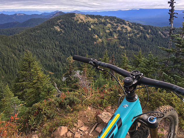
Looking north off the summit. Crescent Lake down below.
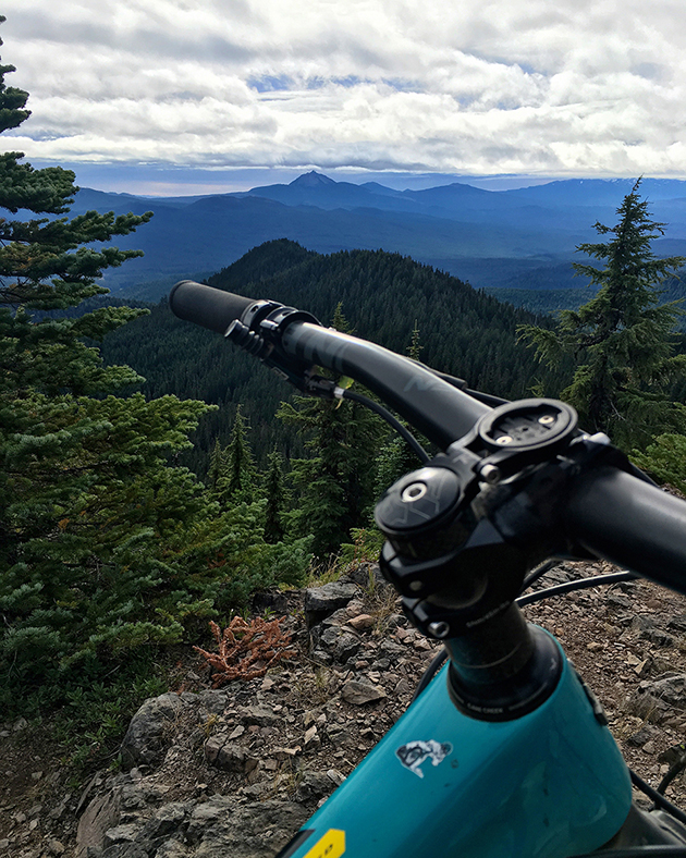
Washington in the BG
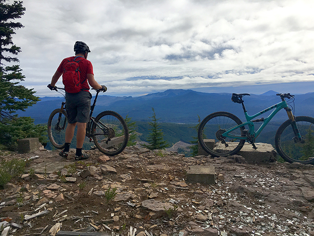
After a break, we started the descent down Crescent Mountain South. The trail starts out fast and steep under the forest canopy and we were flying down some amazing trail. Suddenly I noticed a down tree and hit the brakes – which resulted in a long, slippery slide down the hill on my side. The tread here is solid and the wheels don’t grab dirt like they do in Bend. Especially when coated with pine needles. After this short decent off the summit, the trail opens up into a stunning alpine meadow.
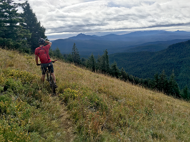
View break in the meadow. Mt Washington in the distance.
Crescent Mountain South only had a couple downed trees up top and was obviously more cared for than Crescent Mountain North. This trail is also easier to access and more readily used by hikers and hunters. The tread was lightly visible in the meadow due to the fast growth of the grass. Since this ride, I found that the trails, in general, were cleared every other year – but some sections were cleared less frequently (upper S. Pyramid for instance).
Should We Promote these Trails?
This topic of conversation came up early on. Since that time I have come to the conclusion that these trails will never be flooded with bikers. Here’s why:
- The trails are remote. Most have no cell service.
- 30% + slopes are common and hike-a-bike is a frequent reality.
- Several sections of trail are eroded by water draining down the trail. Leaving roots, rocks and often a trench.
- The trails aren’t close to population centers. From Bend, it’s almost as far as Oakridge.
- It’s very hard to self shuttle these trails, and the most extended downhills (like Crescent Mountain) can be shuttled from one side of the mountain, but you still are going to need to climb 2500 ft.
- There are no services in this area. No food, no coffee, no bathrooms.
One group backpacked for 4 days on the loop and told me that the trails were more suited to hiking than MTB use. They concluded that 1% of riders would enjoy them. This statement has merit being that they were designed as hiking trails. However, that’s the kind of trail many people seek out. You aren’t going to find flowy berms, IMBA grades or features here. Anyone who likes remote, raw and rugged back-country trails with the promise of some hike-a-bike should have fun. It’s an adventure!
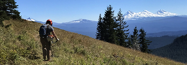
The reality is most of these trails need your tires to keep that brush in check!
What’s Happened Since?
A LOT has happened since this first exploratory ride. Many of the trails are now open and rideable, barring any new deadfall from this winter. Our sponsor Horse Creek Lodge & Outfitters will also be offering guiding and shuttles in the area. You will still need to reach each peak on your own power – but at least you can have a car waiting for you on the other end!
In my next blog post you can read about:
- Working with the Detroit Ranger District (under the umbrella of COTA), in partnership with the Salem Area Trail Alliance to accomplish work in this zone.
- How the Oregon Timber Trail Alliance invested in these trails.
- How Trans-Cascadia took the lead in advocacy, planning and on getting all the work accomplished.
 This article was contributed by Joe Myers. Joe has been publishing trail reports, photos and maintaining trails in Central Oregon (and beyond) since starting BendTrails in 2012. When off the bike he works as a 3d designer/animator at Sketchbook, Inc.



Anyone been out there this year? Curious about snow level on this loop currently
Thanks, Joe. That is some gorgeous terrain. Thanks also to all the other volunteers who put in so many hours improving trails.