Helipad Trail
Trail Snapshot:
Trail Description
E-bikes allowed on Helipad
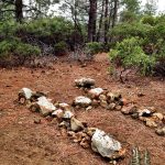
Helipad is a steep and technical trail that brings you to the top of a ridge with an opening in the tree cover that looks somewhat like a helicopter pad. There is an H made of rocks that someone placed at the top that is a favorite photo backdrop for visitors.
The trail was designed by Paul Thomasberg, and is known for being one of the steepest climbs close to town. Originally the trail was called Paul’s Trail, but most people call it Helipad. It’s official name changed recently to Phil’s trail, so it’s officially Upper Phil’s. We chose to list it as a separate trail due to the trail being so much more difficult than the rest of Phil’s.
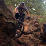
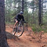
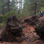
The trail has many technical obstacles including lava rock, loose rocky pitches, roots and brutal climbs. There are at least 3 false summits on the trail. Just when you think you made it to the top you find yourself at another climb! The last steep pitch sends you straight up a bouldery “Crack” with a tough rock step-up start followed by some tight corners. Don’t sweat it if you have to walk this section (95% of riders do). Helipad has been more of a climbing trail in the past, but it’s one of the more exciting technical downhill trails near town. Just be mindful of climbers as you descend as sight lines are not very open in many spots.
This trail is maintained by Central Oregon Trail Alliance.


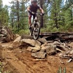
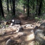
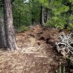
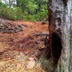


A couple snow drifts in the usual places (bottom of the first cascade of descents and the backside of the switchbacks after the saddle) but they are quickly shrinking. Lots of pine cones but between that it’s sweet sweet dirt!
Riding well. There was a little bit of snow at the start (i.e. from the trailhead on the road), and one small section about 1/3rd of the way down, but totally fine, and in general, the trail is great – no dust, moisture has made it solid, etc.
Recent moisture hasn’t really improved the tread. Still super soft and blown-out in many spots.
Still steep. All clear.
tree now clear – thanks mr guy
Still snow on upper portions of trail.
Light dusting of snow! Good grip as long as its frozen… which I’d say only go when its frozen at this point. Otherwise you’ll be digging trenches and doing your drive train no favors.
Phil’s (helipad) Trail is closed between the 4601-336 Road and the 300 Road mon – fri starting on 10/18. Downhill riders can reroute around the Phil’s Trail closure by following the 4601-336 to the east and then taking the 300 road to the north to its intersection with Phil’s trail.
Hey guys, do you know how long the weekday trail closures are going to last? Thanks!
The USFS will not estimate how long the weekday closure will continue. It depends on how fast the contractor works in the area. Once they ‘finish’ they’ll move to a new area. The can only close one area at a time.
Trail is basically clear – but the normal flat road like section below the first long decent still has snow.
Rode Nov. 9 conditions loose and sandy, surprising lack of tackiness on the trails this time of year. Still a classic and still an a$$ kicker!
Rode downhill yesterday and it was in great shape. Dust is all gone. Curious what the trail is that crosses helipad about half mile before ext. Where it starts and where it goes.
pretty sure it’s just an old road that looks like a trail now. Same road crosses whoops
Rode upper Phil’s Friday night (5/5) all the way to Whoops without any problems what so ever. Unless you count the last 2 rock climbs which are still kicking my ass just as I remembered.
I’d actually say this is riding well. Just one ridable snow patch below the helipad. Then 4 or 5 short hike-a-bikes from SK Jct to the bench. Another weather day like today and it’ll probably all be rideable.
Totally clear until the flat section before the last climb, 300′ below the Helipad
Riding mostly well, save for a few squishy spots.
From rd 300 up to Storm King intersection is clear of snow and mud. Some blowdown (3 trees i think) and snow patches on the way over to Whoops benchs
Three trees on the west side still in play on the way to the top of Lower Whoops. Downhill was killer today.