Olallie Trail
Trail Snapshot:
Trail Description
E-bikes NOT allowed on Olallie
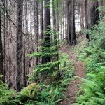
Beginning at Olallie North Trailhead, Olallie Trail #3529 starts a climb up a steep ridge to the north of King Creek. The trail travels through a coniferous rainforest, occasionally breaking out of the forest onto rock outcroppings and madrone groves. The trail travels southeast, climbing the ridge, then winding along the ridge between peaks and mountains before reaching Forest Road 1993 and Pat Saddle Trailhead.
The trail continues south from Pat Saddle Trailhead, immediately entering the Three Sisters Wilderness and following a ridge around to the base of Olallie Mountain. The trail continues downhill past Olallie Mountain along the northeast edge of Olallie Meadow and through Bear Flat. Bearing south, the trail passes the upper reaches of French Pete Creek and wraps up and around to a ridge over the South Fork McKenzie River drainage. The trail then drops steeply down the ridge along a tributary of the South Fork, leveling out before reaching its terminus at South Fork McKenzie Trail #3327 near Olallie South Trailhead.
Trail description from the US Forest Service website.


Lots of deadfall past Horsepasture intersection towards Pat Saddle. Turned around after a mile or so. Wondering if this ever gets cleared these days ? Could make a cool loop with Saddle trail, which is an awesome downhill (and also has a bunch of deadfall)
started at the north trail head. all clear to the o’leary junction. Lots of debris on the trail tread + some brushy sections. Did not venture past the o’leary junction but could see several medium size trees down.
still a LOT of deadfall on olallie-passed some folks from Eugene with a chainsaw out early Saturday so hopefully some of it is cleared. everything from oleary to king castle has been cleared (thank you!)
All clear and riding well from the NW trailhead to the O’Leary junction.
Clear of trees from horse pasture to O’Leary. However insanely brushy. Needs some love.
Ten trees across south of Horse Pasture Saddle, some large, but all fairly easy hop-overs. One small tree across north of O’Leary.
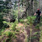
Rode this June 22nd as part of the Olallie / O’Leary epic loop. Conditions were good, with a warning that a lot of the climb is on a very tight trail with a cliff edge. Some parts had a little washout / collapse, and others were loose with usually shale rock gravel. Hike-a-biked a couple of those sections for a 100 ft or so at a time.
Incredibly beautiful sections of trail, though. This really gets you out there and into more natural trails.
Looser and narrow stretches seemed mostly below 3500′ in the north facing burn, probably harder going up.
Ran ollallie-O’Leary-castle. Trails are in great shape. First time out there and completely blown away! Found sunglasses, reply if they are yours.
Yes, mine! I posted on FB a week ago that I lost a pair of Oakleys, amber lenses.
Just south of O’Leary there are 3 large snow patches — miles 3.75-4.5ish. Passable, but not rideable. Beyond that there are 6-8 down trees that need attention. Made it to mile 8 before snow was too much. Definitely quite a bit of brush on the trail — cleared what we could. Needs some riders/runners!
Section north of O’leary Is now clear. Thanks Erika, Suzanne and whoever else with The did work event.
Good to go up to the O’Leary intersection. Beyond that, who knows…
Snow line at 4,900′ as of May 7, 2017. Or the forest service road just before O’leary trail intersection.
Were you able to hop onto Olallie from NF 1993 then ride down to O’Leary?
As FS road is closed 3 miles up, I opted for the Olallie trail uphill instead. What a stiff climb! However, as it is not a technical uphill, one can make great friends with one’s granny and spin away, upward into the clouds. Olallie was damp and sticky yesterday and steap as it is, I rarely had to get off my bike. It seems to be the trail less traveled, so enjoy!
FR 1993 above Ollalie TH has 1 big rock slide, 1 medium rock slide and 3 smaller ones to scramble over. Recommend Ollalie single track climb instead if you plan on looping to O’Leary, Castle Rock and King Castle. Otherwise the tread is good, not any where near the dust Bend has currently.
The big tree has been cut out but there are still a fair amount of smaller trees down. Good excuse for stopping to take a breath and get an upper body workout. Otherwise the tread is perfect.
We rode Ollalie to the O’Leary junction then continued on O’Leary/Castle Rock/King’s Castle 6/11/16. One big giant tree laying right down the middle of the trail right after you get on the Ollalie singletrack post road climb, but actually kind of fun to walk down the tree. Otherwise, just a handful of trees down, but not enough to ruin the overall flow of the ride.