Expand Map Expand Page
Metolius – Windigo (Todd Lk) Trail
Trail Snapshot:
Trail Description
E-bikes NOT allowed on Metolius – Windigo (Todd Lk)
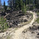
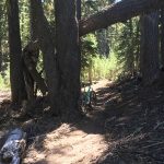
The Metolius-Windigo trail is over 100 miles long and begins in the north at the Mt. Jefferson Wilderness and runs all the way south to Windigo Pass near Crescent Lake. To minimize confusion the “Met-Win” trail — as it’s often called — is broken into distinct segments each with its own character.
This segment of the Metolius-Windigo is very popular with equestrians, so please use caution while riding and yield to horses. The trail goes directly through Todd Lake horse camp where it crosses the creek and then jumps onto a section of double track before going back to singletrack and heading over to the intersection with Bachy West XC.
This trail is maintained by BackCountry Horsemen.
CONNECT WITH BEND TRAILS
©2026 MTB Trails LLC, All Rights Reserved
A Project of Sketchbook Inc. and Delicious


Deadfall from Dutchman to Todd Lake had been cleared. There are still several large patches of snow. They are easily crossed on bike or foot. Bring the bug spray, the skeeters are viscous!
Met-Win Todd Creek horse camp to Happy Valley is now clear of deadfall. Thanks Tom Lomax and Don Leet for swamping today.
Rode from top (Upper Flagline intersection) down to highway on 7/24. All clear of snow, but two large trees down toward the bottom: one very large (3′?) rotted tree about 1/4 mile up from highway, and another more like 20+” tree about a mile up from highway.
Snow gets real deep (5-6′) not very far up from North fork. Give it a week or two.
One large tree approx. .75 miles north of cascade highway.
Cleared
Two trees between Upper Flagline and Happy Valley. 30 inch plus. One is an exploded tree on trail at 44 3.572 x 121 37.628, other needs bucked out 44 3.523 x 121 37.835. Otherwise the trail is good to go.
Last post is the wrong section of trail.
Half a dozen snow patches, only two weren’t rideable. Couple muddier areas, but almost all of it was rideable.
Getting horse use. Loose near the horse camp.
Also a couple of deep puddle crossings.
trails clear now per OTTA (Adam craig)
Dusty.
Rode from the horse camp (Todd Creek TH) to Upper Flag. Just a few unrideable snow drifts but mostly clear and no deadfall.
Super sweet indeed. One new tree down as of today closer to the Flagline intersection…
Started at Todd Creek TH and went about 1/4 mile towards Flagline. Mostly clear of snow in this section with 1 tree down. Then continued towards Bachy West XC which had no deadfall and just a few unrideable snow drifts but mostly clear.
Deadfall report:
1 8-9″ a short distance from Todd Crk TH heading towards Flagline
snow hiking as of today says the oregon timber trail peeps
All clear from the highway to Flagline junction!
Perfection.