King Castle Trail
Trail Snapshot:
Trail Description
E-bikes NOT allowed on King Castle
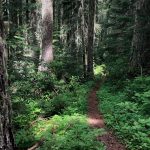
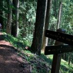
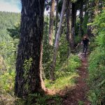
Beginning at King’s Castle Trailhead, King Castle Trail #4326 travels south and east up the northern and eastern side of Castle Rock. The trail meanders uphill over several streams and through an old growth coniferous rainforest. The trail switches back in some steep sections, climbing to and crossing Forest Road 480 before heading west and ending at Castle Rock Trail #3506. — Description from the US Forest Service website.
Most people ride this trail as part of a clockwise loop with Olallie, O’Leary, Castle Rock and King Castle. That way you can climb a significant amount of road which will get you pretty high up on the loop before decending 100% singletrack. The full loop is over 30 miles and 6000+ ft elevation — so brace for a long day.




1 20” or so rotten tree down somewhere in the middle of the descent. Definitely need to dismount to pass
Jack straw of 18-20” diameter trees about 500’ in from TH. Probably more above that.
I’ve hung up my saw & tools due to inconsiderate users (both MTB shuttlers and local hikers) not worth my effort any more. Good lucks and safe cutting!
Received >2” of wet heavy snow at valley floor overnight and still dumping. Please STAY OFF TRAIL until snow melts and trail drains. Thank you.
Down trees & very dry conditions. Be careful
One 10’ splooshy spot of mud otherwise perfection.
Trail reported to be basically good to go! One small patch of mud near the bottom. Cheers.
Snow is gone, prevalent mud now. Needs another day of draining. Please respect that and ride elsewhere. Thank you.
Received 3″ of wet heavy snow over night at valley floor. Thus the trail will be buried, and prevalent mud where it is not. Please stay off the trails until it has had a chance to melt and drain.
Respectfully, your trail steward of the area.
Thanks
Received about 3” at valley floor last night. As a local, respectfully requesting people to stay off the trail. Prevalent mud under wet, heavy snow.
Not a drop of snow on the whole trail. Loam town.
Good to go
Having received 8 inches of rain in 72 hours, not advisable to ride trails on this side of the crest.
Trail has been successfully logged out and is passable (with patchy snow, and a lot of debris on trail from log out). However, many trees have fallen ripping up the tread in many places and with recent rainfall it has become a sloppy mess. Being a local I would respectfully request people avoid riding/hiking this until we get some more warm dry weather so tread can be fixed and raked.
A volunteer work party (Scorpions and Salamanders from HCFV) started clearing 3/22/19. The density of deadfall from snow-mageddon is astounding—-a jack-pot pile-up every 30-50 yards often making the trail unrecognizable, and passable only crawling under or over multiple tangled trees. About one mile was cleared, to a 60″ old growth tree across the trail. Definitely not possible to bike or hike this trail yet.
Also, this map needs an update. O’leary road is 480 (2639480 for those that know FSR roads well), not the 482. FYI
Thanks Ryan. That road name on the map comes from Google Maps. We’ll report that it’s not accurate — hope they’ll update it for us.
Trail is covered in deep (6″-8″) wet/heavy snow with some dead-fall included. It’s going to be a while before this is ride-able again – I’m a local in McK B
Rode from King Castle TH up to the road. Trail is in perfect shape. All clear no trees down.
Perfect Cascadia dirt! There’s one large downed tree in the middle of the reroute. Other than that clear all the way to the summit!
Rode on April 4th, got to mile 4 and had to turn around due to timing. Trail was perfect!!!
Crazy perfect from the King Castle TH to NF 482 and back! ~2hrs with break at the turnaround.
Rode an out and back from King Castle TH to Castle Rock/O’leary TH. Excellent conditions!! One down tree about 1/2 mile from King Castle TH.
Trees were clear as of the end of April (DoD Happy Ride). A little muck at the very bottom where the short bridges are, should be dried out after the recent heat wave.
2 trees reported as down, but perfect conditions as of yesterday.
This trail was perfectly damp yesterday and so much fun!
So good! We rode the loop encompassing the road climb/Ollalie/O’Leary/Castle Rock/King’s Castle on 6/11/16. What a way to end a big ride! Sicktastic!