Expand Map Expand Page
Scotty Creek Trail
Trail Snapshot:
Trail Description
E-bikes NOT allowed on Scotty Creek
The Scotty Creek Trail is 4.3 miles long and starts at the Scotty Creek Trailhead, located along Forest Service Road 250 just north of Mill Creek Wilderness — and terminating at the Cougar West Trailhead.
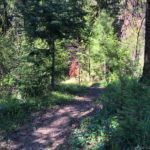
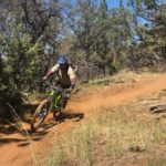
This fast downhill trail quickly drops 2500′ as you head north by northwest through stands of Ponderosa pine and mixed conifer before joining the Scotty Creek drainage and passing its confluence with Grant Creek. You can ride it as a shuttle, or as a loop by climbing the Cougar Creek trail.
Climbing Scotty Creek is not recommended. It’s very steep and loose and the Cougar Creek up-routes is a much better climb.
This trail is maintained by Central Oregon Trail Alliance.
CONNECT WITH BEND TRAILS
©2025 MTB Trails LLC, All Rights Reserved
A Project of Sketchbook Inc. and Delicious


Already getting a little dusty and loose with a fair amount of brake bumps. But… still a great ride.
Scotty is all clear of deadfall, however the top section to the first road crossing is still completely snow covered. No snow below that. The paved 27 road to the upper trailhead is also not drive-able for the last half mile, so we still need a couple weeks for free and easy shuttle laps.
Cleared Scotty today. Still a bit of snow at the very top before the first road crossing but other than that it’s ready to go.
Cougar Creek and Scotty Creek are clear. This might be the last weekend this year before snow sets in so go get ‘er.
The newly rebuilt Scotty Creek Trail is open, cleared of deadfall and riding awesome now. Go check it out, you won’t be disappointed! Best ridden with a shuttle and you can get a few laps in a day.
Scotty Creek Trail is temporarily closed while Dirt Mechanics completes rehab work.
The Ochoco National Forest received a dusting to a few inches of snow this week depending on elevation; if heading out be prepared for all conditions.