McKenzie River Trail
Trail Snapshot:
Trail Description
E-bikes NOT allowed on McKenzie River
The McKenzie River Trail is one of the absolute best mountain bike trails in North America. Nearly 25 miles in length and slightly downhill (when ridden as a shuttle), the trail’s stats are a bit misleading. Most riders will take at least 4 or 5 hours to complete the ride partly because of the technical upper trail and partly because of the number of amazing photo opportunities to stop and regroup.
The trail is heavily used by hikers especially around the area of Tamolitch Pool (often referred to simply as “Blue Pool”), so in 2020 the the trail was rerouted for bikes to bypass the section which has the most hikers.
The first 10 or so miles are a “black-diamond” technical trail, with lots of “exfoliating” pumice and lava (knee pads and platform pedals are a good idea on the MRT). After that, the trail becomes an intermediate route with lot of flowy twists and turns to the bottom. Riders who want to experience this epic ride but are not comfortable with rock gardens can start the ride at any number of mid-way points — the Trail Bridge Reservoir at Tamolitch Pool trailhead being the most popular.
Another option for those that are not into the rocky terrain is to stay on the West side of Clear Lake. This is all singletrack along Clear Lake Trail is fairly smooth and actually a little more scenic. Old growth forest vs lava landscape.
Hit up Horse Creek Lodge & Outfitters for a McKenzie River Trail shuttle.


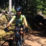
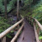
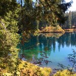
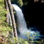
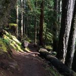
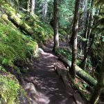
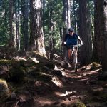
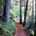



Great to have the whole trail open again! We rode out and back from Paradise to the Blue Pool. First time on the Blue Pool biker bypass. Not as gnarly as the hiking trail, but still a technical thrill for us. One large tree down near the bottom of the bypass. So good.
Entire trail is now closed per horse creek lodge due to fire activity. Shuttles on O’Leary are still operating on good air days
Confirming the closure from south end of Trailbridge Res to Deer Creek. Trail is blocked and signs says it won’t reopen until Nov 2023. The ~2.5mi detour on gravel & paved roads is exposed and not particularly fun.
Official word today from Horse Creek Lodge is that the detour below Trailbridge Camp is now mandatory. The burned section of trail is getting logged out and has heavy machinery on it. Other than that, the washed out sections of trail on the side hill have been repaired, and the lower section seems to have been brushed out recently. It’s riding really well right now. Really impressed with horse creek lodge and their staff as well.
All clear as of June 4. Thanks horse creek for the shuttle and amazing intel on all the trail issues. One section is now closed in the burn – which will kick you out onto a road. There is a log crossing that is very easy – and not sure why it’s closed exactly.
Rode the whole trail on Saturday, 5/20/2023 from the top, but chose to go around the west side of Clear Lake (the easy way). There was some hike-a-bike along the lake, by the bridges where you cross Ikenick Creek. More hike-a-bike between the south end of Clear Lake and the highway crossing point, but still not too bad. Clear sailing after that with the exception of 9 or 10 down trees between Sahalie Falls and the Blue Pool. Someone has been busy clearing and you could see a lot of sawdust from recent work. Overall, in very good shape, no mud and nice and tacky. I’m guessing it will be free from almost all the snow within the next two to three weeks.
Four trees down from upper t.h. to belknap.
First at the hwy crossing below clear lake.
Second- a big one 44.2421 -122.0209
Third- a big one 44.2421 -122.0550
Fourth- small rotten one 44.2065 -122.0429
There is also a hanging headbanger that is flagged just before the deer creek crossing.
Report from Horse Creek Lodge in 5.12.22: “Snow is mostly clear, upper trail clean up scheduled for the coming week; clear from Deer Creek down.”
Upper MRT still snowed in; clear from Deer Creek down as of 4/23
The Knoll fire is in the mop up stage, meaning local crews are monitoring it and cleaning up as it continues to burn itself out within its established perimeter. The section between Trailbridge and Frissell will be closed through the rest of the season. The upper half is running great and is still a shuttle option, or even if riders want to ride the road, that’s an option as well.
Blue pool trailhead down is clear of snow and mud. Only three trees down.
The new Blue Pool bypass is super sweet. Thanks to all who built it!
Hiked from the Upper trailhead to Sahalie Falls and back on 4/28/20. This segment of trail is mostly snow free and what snow that is left is minimal. There are however, several gnarly blowdowns/blowdown patches some of which would be quite cumbersome to get a bike around/under/over. Glad I came on foot first to check it out. There are a couple small ones about 0.5 mile in then a good gnarly one at about the 1 mile mark. Then a few more between there and the junction to Sahalie Falls. I have pictures but I’m not sure if I can/how to post them here. Not much mud to speak of.
Hey Whitney. I sent your reports to Horse Creek Lodge and they forwarded them on to their contact as the USFS. Sounds like some trail work by the FS is scheduled soon.
Awesome! Thanks!
Clear and dry up to Trail Bridge reservoir — turned around there but is was still clear ahead.
Riding well, dry, only one tree down. In the upper half, but can’t remember where. Took me 5hrs and 25 minutes with short stops at each waterfall, walked some lava and dismounted at least a half dozen times for hikers (no problem). Riding on a Monday in August is primo. Horse Creek Shuttles do and excellent job. My mileage clocked in at 27.7, another rider at 28.1.
So you can get a muddy 4 miles in from the bottom up. About the 4mi mark the trail is gone. After that I hit 15-20 deadfall, so I’d say it will be a bit before we ride
A section of the McKenzie River National Recreation Trail will be closed from the Tamolitch (Blue Pool) Trailhead near Trail Bridge Reservoir to Tamolitch Falls (Blue Pool) on October 1 – 4 and October 9 – 12 for maintenance. Crews will be working on improving the trail tread.
Hikers, bikers and other recreationalists will still be able to access Tamolitch Falls (Blue Pool) by parking at the Carmen Smith Reservoir and hiking 3.3 miles (one-way) south on the McKenzie River National Recreation Trail.
For more information on the alternate route and to view the closure order, visit https://go.usa.gov/xPDbZ.
McKenzie River Trail was riding great today. However, it is very shady this time of year and the temperature stayed at around 40-45F the whole time. It is a deep canyon and the south ridge blocks a lot of sunshine. I rode up from the Ranger Station about 10 miles out and back. Justin Zak started at Clear Lake lava trail and did the whole thing yesterday. What I saw of the trail today was no mud, slimy roots, and great dirt.
Can’t remember the exact dates, but we saw posters yesterday that said the trail from Blue Pool to Trailbridge will be closed for maintenance various days the first few weeks of October. Best call the ranger district ahead.
Would like to ride this from the bottom to Clear lake and back in one ride… looks like this would be ~50mi and ~5000ish ft… normally I would expect this to take 6 hr… but the comment in the description says just down takes 4-5 hr? Can anyone confirm if that timing is realistic?
That’s an accurate time for most people. Lots of stopping at views of waterfalls and blue pool etc. lots of technical lava for miles. TONS of hikers around blue pool. Other than this few miles it’s all fairly fast riding.
hey thanks – so sounds like I should plan on this being like 8 hr if I did out and back?
Rode full from Clear Lake to McKenzie Bridge using Horse Creek Lodge for a shuttle. Flooding after Carmen Reservoir has receded to about 5 deep puddles. Warning signs are up, but traffic was active. We were able to portage around 3 and ride through the other 2 puddles. Wet feet, it was really cool to see Tamolitch Falls raging!
Heads up to mountain bikers and hikers on the McKenzie River Trail. Spring runoff has caused heavy flooding on the trail for the first 1/2 mile south of Carmen Reservoir. At this point the trail is impassable until water levels drop.
The flooding is likely to persist for another two to three weeks. Trail crews will monitor the level of water weekly and we will post updates on our website and social media. You can also contact the McKenzie River Ranger Station for updates by calling 541-822-3381.
Rode Paradise to Deer Creek on 3/30/18, and conditions were very good. No real mud, and only damp/wet here and there. We hiked to Blue Pool two days before, and it was pretty sloppy there (mud, standing water, and snow).
Rode from Trail Bridge camp down (3/25/18) and there was still quite a bit of snow, started with about 4-5″ lasting for about 6 miles. Lots of standing water quite a bit of snow, a little mud and a bunch of down trees across the trail.
snow and mud on the upper half, and a small section about .5 mile downstream of Deer Creek was wiped out when a couple of big trees came down. Riders/hikers can get around it, and the FS crew is out today apparently working on a re-route.
Called the ranger station this morning and the lady i spoke with said she had been running lower mrt and it was good. Ventured over to Paradise campground, and rode up to Trailbridge reservoir and back! Conditions are pretty good, definitely some slick roots and bridges. There were a few down trees. Only saw 4 people. The upper section has snow and i’m sure down debris.
Rode MRT yesterday, and found the deep water section can be avoided by bushwhacking to the right (when headed South). There’s evidence of several folks making their way around the water — just follow the improvised path. Wouldn’t hurt for a machete owner to bring theirs and cut some underbrush. :-)
Rode it yesterday and came across the area you were talking about. There was a 6-7 person trail crew working on it. They put in a temporary crossing made out of planks in the downstream area and were in the process of putting in a permanent bridge. They said the permanent solution should be finished by Wednesday Oct 18.
Rode yesterday. Conditions/weather was excellent! Experienced one section of deep water near Carmen Reservoir, luckily i had just caught a couple that were ahead of me. They both fell in trying to ride across. I removed my shoes and socks and forded across. Hip deep water! There were maybe a dozen down trees on the journey down from there.
There has been a water release from Carmen Resevoir. On Sunday, there was significant flooding til almost the Blue Pool. Waded through literally hip deep water for at least 50 foot distance
Rode MRT yesterday and I can confirm that the flooding is still there. Kind of surprised that there is no warnings posted about it to be honest. My friend and I came upon 2 hikers equally caught off guard. I looked for a walk around but didn’t seem like there was going to be anything close so we decided to hike up our shorts and ford it. The thigh deep water at the start gets deeper in the middle (at 5’7 my shammy did get wet so depending on your inseam you might be able to get through unscathed). We came upon the hikers again and they reported a dry clearing but only after a pretty significant detour. Both options are not great at this point so pick your poison. Still had an epic day despite my damp shammy.
The Lost Creek Bridge on the McKenzie River National Recreation Trail (MRT), east of Paradise Campground and west of Belknap Hot Springs is undergoing repairs beginning June 7 and continuing through early July. There will be no access across Lost Creek during this time.
The McKenzie River Trail will remain open on both sides of the construction zone. Limited parking and access to the trail heading east is available at the Lost Creek access point. The nearest access heading west is at Paradise Day Use Area.
Click for More Info »
Hi Jeff. How did you add a link to your comment?
Rode this trail on Memorial Day. Parts of it were dry and some parts damp. We also encountered hoards of people on the Blue Pool trail, despite recent road closures. Major holidays are bad days on which to ride McKenzie river trail. Too many people!
Up and back from Paradise CG to Trail Bridge today – one downed tree and spots of mud (mostly along the usual spring fed cliffs). Ran into people coming down who had started from the top. They said they pretty much walked the first two miles due to 4′ snow piles but then the snow pretty much stops where the waterfalls start – and no downed trees (?)…Almost ready!
You can get in a nice 16-mile out and back ride if you start at Deer Creek and head upstream. The trail was in pretty good shape on Saturday 2/29. Snow patches and down trees became pretty prevalent about 2 miles above the blue pool. My wife ran out and back going the other direction from Deer Creek and said the trail was a little wet, but in good shape.
April 23rd. Deep snow at trail head. Snow continues through Sahalie Falls area. Hike Tam Pool…. very muddy with deep puddles
Started at Deer Creek (milepost 14.5) and was able to get about 1/2 mile beyond the Blue Pool before the snow patches became too numerous. The trail is in very good shape. Almost no puddles and pretty darn firm. Can’t speak to anything downhill from where the trail crosses Deer Creek road, but it would surprise me if it wasn’t in great shape too.
I should have mentioned the date. I rode it Saturday, 4/15/17.
McKenzie river trail from the ranger station to the tamolitch pool TH is riding well overall, especially with the solitude and wonderful weather. Best riding hours, in my humble opinion, are between 10 and 2, soon to be 9 and 1 starting next week :(. My bike stayed pretty clean, sans rear fender. However, I counted 5 trees down, a few muddy spots, and many soft spots. Beware of slick roots, leaves and bridges! Vigilance and finesse required!
Fish Lake to Deer Ck is stellar…
MRT has a few down trees here and there but still riding well as of today.
Stellar trail conditions on MRT as of May 29. Don’t bother riding MRT memorial day weekend or likely any other popular holiday weekend! Hundreds of people decided to visit blue pool. What a hairy ride from blue pool to trail bridge reservoir because of all the people.
yeah, lots of people. which is leading to this :(
http://www.statesmanjournal.com/story/travel/outdoors/2016/05/20/bike-bypass-coming-mckenzie-river-trail/84625498/
Upper MRT and Clear lake trails are free of snow and mud.
A few spots of snow before Clear Lake. Then several spots of snow (hike a bike) from bottom of Clear Lake to first crossing of 126. After that not much snow. Some puddles and mud but not too bad. Maybe 3-5 blow downs still on the entire length. Fun day.
I was on the McKenzie today. Its riding very well and only has a few wet spots. We started counting the hikers in the 2 mile stretch from the Blue Pool to Trail Bridge with a grand total of 102. To think they would complain about a couple bikes is so funny. All was good and no bad experiences. Remember to talk to the hikers or they get spooked like horses do.
Rode Sunday 4/4 from Sahalie Falls down. Couple snow patches at first but excellent riding. Lots of hikers at Blue Pool. Rippen good times.
4/3 that it is.
The trail is in great condition from Sahalie Falls on down. Rode through a couple of small patches of snow, but all were pretty easy to make it through.
Fish lake to Sahalie is currently pretty buried in snow and probably unrideable.
Low down on the trail – Belknap or so – there were about four deadfall that required carrying the bike over, but all of them were pretty easy and you can see that the folks who maintain the trail have been working pretty hard and doing an excellent job. I would guess that those remaining deadfall will be taken care of within a week or two.
Riding well from f.s. station up to Deer Creek road, some wet spots but completely worth it for this time of year. Down trees every 5-10 minutes.
The lower part is great. From the ranger station up to the reservoir. There are some trees down though.
I make a point of riding the MRT at least once a year — and when visitors come to town, it’s a must-ride destination. The upper rock gardens alone are well worth the drive.