Trail Description
E-bikes NOT allowed on Tiddlywinks (Upper)
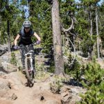
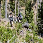
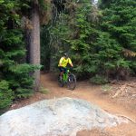
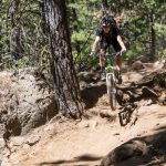
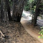
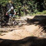
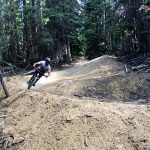
Tiddlywinks starts out at Wanoga Snow Park and is a little more flow-oriented than Funner, with less rock and more berms and jumps along the middle section. The top section of Tiddly is more XC style trail and rides out through some open, rolling terrain with some rock gardens, and then intersects Kiwa Butte trail. Expect to find a few spicy rock gardens in the upper sections of trail through the clearing.
After the intersection with Kiwa, Lower Tiddlywinks and heads down through some heavy berms and flow style jumps on the order of Lower Whoops trail.
This trail is maintained by Central Oregon Trail Alliance.
CONNECT WITH BEND TRAILS
©2025 MTB Trails LLC, All Rights Reserved
A Project of Sketchbook Inc. and Delicious


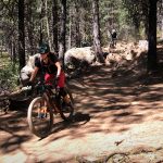
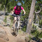
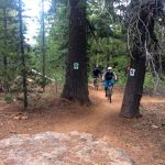
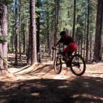


Rode the other day. Expect it to be sandy, muddy, snowy, with lots of puddles, and greasy in most places.
The entire length of Tiddlywinks will be closed October 7-11, due to maintenance in the area. As per the USFS.
Closed due to Fire.
Sad thing is that no one reported this as closed for the Bachelor Complex fires.. I hesitate to even post this so that everyone else can also figure it out on their own and waste time on this site
We just cleared Tiddlywinks of trees. There are snow patches but mainly clear.
Still tons of snow at the top. Gonna be a bit
The trail is running sweet! Some sand and loose but overall packed and fast. Expect some wash boarding through the middle and tops of berms.
A few small patches of snow after entering the forest but they’re rideable. The rest of Tidly was mint.
Trail now fully clear of trees. Still some snow. Thanks for the work don + swamper
Trees on up and down routes cleared the last couple days up to 4613 road (red cinder road). Not sure if trees reside above that. Thanks Joe, Neil, Tim, Ben and John
Trail clear of snow until power lines on uphill route, then rideable snow to end of lower section on uphill route. Lots of down trees starting at FS-700. Upper tiddlywinks is mostly all deep snow in the trees, easy to lose trail. After a quarter mile south of wanoga sno park there is a mile of clear trail but then snow again.
2″ snow but nice and packed starting from wanoga down about half way.
Trail closure has ended. Tiddlywinks is now open seven days a week.
Currently perfect.
a few trees still down and still snow on upper trail
Saturday, 5/14, from Noon to 1 PM the PPP mountain bike leg will have racers descending on lower Tiddlywinks from FS 4610, down to Lower Storm King. Please take note!
8” ish tree down in upper tech section near wanoga.
Tree is gone, also the two trees on the uphill are also cut
2 trees down on tiddly up route as of today. One is maybe 12” with a branch ramp that’s been there a while maybe (first time in years climbing this trail/road). Another is maybe 5” or so near road conversion jumpy section.
First time riding this trail and it was a blast. It really has it all. Easy climbing to warm up your legs for a fun and flowy descent.
For any new riders, this took a little over 90 minutes and that was with a few breaks and map checks to make sure we weren’t lost.
All clear of trees on the descent. Several mostly rideable snow patches. Get it.
Completely clear and the brake bumps are developing. Tracks from yesterday’s marathon still on the trail.
Wanoga to 4613: Miles 1 to ~2.1 – Plenty of snow hike-a-bikes and tree fall to crush your spirits.
4613 to Kiwa: Couple of snow hike-a-bikes
Top of Tiddlywinks: No tree fall until you get below the jump lines and into the first flat area. Couple of large snow patches in the jump lines.
Flats and lower jump lines to power lines: Some snow and small tree fall. Main exposed jump lines are clear.
Power lines to bottom: All clear. Let ‘r rip!
Still hike-a-bike through snow lots of snow patches from Kiwa to the next road crossing above the second jump section. Probably another week or so.
Below rd 490 (i e. Power line) ->
Down route: all trees clear, one patch of snow
Up route: 11 trees remain (small-med)
I should have known you would be all over this! :-)
Report from Facebook: Deadfall blocking the trail just below the start of the 2nd downhill section on Tiddlywinks.
Anyone find a driver’s license/credit card? Rode up funner/down tiddly. Thanks!
Only road the top section to Kiwa, smooth and fast.
Couple tree issues on the black line below Kiwa heading towards Wanoga sno-park. One leaner which is easily ridden under but could be a hazard to someone not paying attention. The other is a small tree on the ground that can be ridden around but presents a hazard because you are coming in hot and is on the main line.
Wow. Nice work trail gnomes. Twinks is so good right now.
From kiwa connector through the slalom has a bit of snow. Rideable, but sketchy. After the power lines is wide open!
Upper Tiddlywinks jumplines from Kiwa connector riding well except for the snow and the tree fall. ?. Needs a few more warm days and a sawyer to pay a visit (ya, I forgot my saw). Couple of groms were out raking the berms and filling in the brake bumps. Gave them social distancing high fives. Tiddly below the power lines was great.
FYI – Tried to access Tiddly from Wanoga and was a ton of snow about 150 yards from the parking lot. Turned around and rode Funner down to 4613 them up to Kiwa connector. Tiddly section from 4613 to Kiwa connector had some snow as well.
Upper half is still very snowy.
Only a couple significant snow patches below FS490 are remaining. No deadfall from there down
Walked from the top of the jump line with the mutts this morning and cleared a few trees by hand and fulcrum. A saw will be needed to get a few other trees, and still some big trail glaciers.
Dead fall about half way down the upper “roller coaster” downhill section today. It’s across a fast section of trail and at about chest high. Tried to duck and couldn’t get under it, hit helmet and fell. About 10-12″ in diameter, probably could be done by hand.
Clear!
On Monday the 21st there was quite a bit of snow on upper part of the trail. I would wait a few days before I ride it again. The sun is returning.
Puddles below Larson’s
3 trees down on up route. One around 15″
Ryan and I cleared Tiddly today. What a mess! Lots of snow still on trail upper half, but jump lines are pretty sendy. Cleared around 40 trees.
Rode up a little ways from Larsen’s yesterday. Quite a few trees – 2 on the lower section of the split just up from Larsen’s 1 big 12″ at the top of the “Crux” as it’s called on Strava. Bundle of 3 at the bottom of the higher clearing, then too much snow at the top where the new climbing trail starts to go any further.
Sooo many trees down. Counted 6 huge ones. We rode the whole trail from KIWA down. 6in snow fields on the backside of most jumps, and trees blocking the rest.
Most trees are concentrated in the transfer between the upper and lower DH if that helps. Good to go below the powerline road. Upper did not have many trees down (~3), but the snow made it pretty interesting as James notes…
Cleared the Big Ole tree.
Clear of snow up to Larsen’s. Big ole tree down around half way up.
We broke Tiddlywinks on our fatbikes from where it crosses the 4613 road. 5″ish crusty, tacky snow gradually decreases to hero dirt before hitting the Larsens intersection. Definitely some walking and never had to pedal DOWN the berm sections before but overall fantastic day. Need more fatbikers to pack it out, although looks like more snow is on the way…
Head’s up, there’s a tree down after the big downhill section, when the trail mellows out and just starts going downhill again with the little rollers.
We were going pretty fast and saw it late, but were able to stop. :-)
I marked it here: https://www.trailforks.com/report/432527/
It was probably 8″ in diameter.
There’s another one down after the intersection with Larsen (heading downhill), but it’s easy to spot. Probably roughly the same size.
Both trees cleared. Thanks for the report!
Just a head’s up that there is a trail running race starting at Wanoga on Thursday. The Bend Trail Series start is 6:15 pm and runners will head out on Tiddlywinks toward Kiwa Butte and back the same way. The trail is still open, just wanted you to know there’d be more runners out there than usual so you wouldn’t be surprised.
Hey Everyone! I was riding Tiddlywinks to Storm-king on 06/12 and somehow my keys fell out of my pack. Please keep a look out for a keychain with a Subaru key and 4 different housekeys on it. Thank you!
Fantastic! Did a few laps, tacky up until about 11am and still plenty of fun after that.
Rode it a few days ago. Was riding amazing! It did start pouring rain on my last loop down the fast section. Still probably no puddles though.
Twinks is riding really great. Super fun. I climbed NF-4613 instead of the trail (because I think climbing Twinks is a recipe for disaster). Since visiting riders might not know that’s an option, I added it to the map.
It looks like there will be an uphill route for the really fast part of twinks. Coming soon.
Cleared the two big trees. As well as one on an upper optional line. Also cleaned up a few sticky out trees in a few spots. All clear.
Rode from Wanoga yesterday, there are some patches of snow up at the top but it’s all rideable and not a big deal. There were a few downed trees starting at the jumps but apparently someone came in a few minutes behind me and cleared them. They’re very obvious if they’re still up so don’t worry about coming into one blind.
Trail is open from top to bottom and riding well. There are two down trees bigger than my saw. The snow is minimal and all rideable. Most of the snow is close to the Wanoga Parking lot.
Lower Tiddlywinks riding great, upper is winter mix and 3/4 downed trees.
Removed 4 down trees today. 4/29
Rode Wanoga snow park to lower Tiddly using fire roads to bypass the snow/muddy sections. So take the short little road just behind the bathrooms down to 4614 (the exposed area) which is all dry. At the start of the tech section cut across to the road on your right (Rd 100 I believe or “power line road”. It’s muddy in sections so just use your best judgement to ride around the worst parts. That’ll take you all the way to Lower Tiddly.
Deadfall report:
* 6in tree on right section (lower) of the first split coming up from Larsen’s
* 6in tree on right section of first split coming down from Wanoga snow Park.
Cleared all trees to the top of the whoopdie section below power line road (Rd 100). There’s a few more past that area but I didn’t have any more time and the snow gets pretty deep around there any ways.
Did some walking and scouting; From Wanoga to first road crossing at 4614, still a lot of snow and mud. Ran into a guy riding up Tiddlywinks on his way back to Wanoga and he said there was snow in sections to the Kiwa / Lower Tiddly cut off.
Made it just shy of the power line road, about 2 miles up trail at 5060 ft. Big snow piles at this point. No downed trees.
I only rode to the Kiwa intersection but up to that point there’s a nice 1-3 ft wide corridor of packed snow. My guess is the lower stuff should have a thin layer of powder and also likely rideable on non fat. Ice wasn’t too bad on the upper section but definitely watch out for it.
Stopped by Wanoga to take a look after skiing on Sunday and there’s a couple inches of solid ice on the trail. When that melts it’s going to be a massive mud pit.
Rode on fatbikes from Tiddly to Conklin on Sunday. A little soft and mushy at the top in the sunny meadow area — but once you hit the trees it was frozen and great.
Mushy snow or mushy dirt?
A little of both. Dirt in the sunny spots and soft snow in the shade. That was a few days ago, so no idea what it’s like now…
Patchy mostly rideable snow on our fatbikes from the top until just after the giant whoops section below the Kiwa intersection. Below that perfect tacky or frozen dirt. Super fun!
Decent downed tree after you get past the DH-only section. Trunk was about 10″ but lots of smaller branches and collateral deadfall. You can hike over it.
Low priority but there are 2 trees ~15 inches each on the black line below Kiwa intersection
Thanks for “clearifying”
:)
trail is all clear, Thanks Henry, DJ and Sean!
Thanks!
Two trees down over the trail. Near the Funner, Storm king intersection. Easy to climb over.
2 trees down on Lower tiddly from a report on FB
Dear logging fairies,
Any chance you could cut out the 3-4ish down/semi-down trees on the uphill climbing trail section that parallels the downhill berms/whoops section? Thank you :)
If you shuttle me to the top sure :)
If you’re serious I plan to be at Wanoga at 10 am on Wednesday. Can give you a ride to there or along the way…
are the trees small enough for hand saw? or chainsaw worthy? I will check my schedule and let ya know on FB :)
12″ ish?
The deadfall and learners that were walking distance from Wanoga are clear. Have fun!
I noticed that between successive runs that morning out upper Tiddlywinks from Wanoga. Thanks, Gina (or whomever it was that cut those trees out)!
Amazing the amount of snow that has melted in a couple days. I’d say it’s about 97% rideable as of mid day 5/28. One downed tree on the lower tech section before Kiwa intersection. Heard there was still deadfall on the short section from Wanoga snow park to NF 4614 so I took the quad track parallel to it. Go ride!!
I’ll be out there next week trying to clear that deadfall. I did clear a tree on th section b4 Kiwa on the 27th, is there another one down?
Yes. On the black line near that huge boulder
One tree is sagging (but you can get under it) and one is down and forces a dismount. Both are within a few hundred yards of the Wanoga Sno Park.
Both trees that Robert mentioned are still down. Walking distance from the Wanoga TH.
cleared 5 trees before and after 4613. Still some choppy snow but much has melted in the last week. I’ll survey again next week.
Dry sections can be accessed starting at Wanoga parking lot by taking the quad track that runs parallel to Tiddly until you reach NF-4614 (first dirt road). Go right until the first left which will be road 490 (not sure if it’s marked but its not far after the sign post for Wanoga lot). 490 has all of the power lines on it so that is a good way to know you are on the right track. Follow 490 until you get to the 2ND crossing of Tiddly. Then go left for snow free fun
Here’s a map: https://ibb.co/jF3yha
Cleared trees up to about a qtr mile above power lines. Stopped about where the trail name appears on the map above. Lots of snow starting just above power lines.
The upper part of Tiddlywinks is still pretty much exactly as Eric Kutter described. I continued on through the clearing and it turned into a ton of hike a bike over huge snow drifts once you’re back in the trees, finally bailed out not too much further down on a dirt road and rode back over to Funner… which as of right now is much funner.
Trail is rideable from as high as around 5200′ elevation (where the trail crosses the power line). A few hundred yards above that there are some deep drifts.
Below this point there is one tree down a couple hundred yards after the jump over the rock/bush.
Also the trees previously reported down in the clearing are still there and will need someone with a chainsaw.
Walked from Wanoga this morning. Mostly snow covered up to 4′ deep until you get to the big clearing just past XC ski trails. Then mostly clear across the big clearing except through the technical rock section at the S edge with drifts up to 4′. Then largely snow covered once you get back into the trees on the E side of the clearing.
Trevor and I rode up Tiddly yesterday and got all the way up to just passed the second clearing as you climb up, heavy drifting on the next steep climb that follows. There’s a proper tree down just as you enter the first clearing on the climb up, as well as a man killer snag poking out into the trail right before that tree. We wrestled with the snag to no avail, a saw is needed to defeat this downed lumber. Happy shredding!
Any new updates on tiddly?
Riding well from Storm King to Kiwa Spring Rd.
Still 2 to 3 feet of snow across the big open area near Wanoga.
Big trees down in first half mile above junction with Storm King. Snow before junction with Larsens.
Trees now cleared on Tiddlywinks between Storm King and Tyler’s.
Sweet. Did you mean up to Larsen? Or did you clear Larsen too?
Oops! I meant Storm King and Larsen. Will head up to Larsen for clearing tomorrow.
Descended Tiddlywinks from Kiwa JCT. Probably 1″ of snow at the JCT. Descent was fresh snow, but rode well. Half way down turned to dirt/slush mix. Fun as always.
From the top: Scattered 1-2″ snow/slush patches with occasional running meltoff and standing water from Wanoga Snopark to just to the start of the whoops 100 yards past the Kiwa Butte intersection (snow mostly on flat areas in the shaded trees – interspersed with hero dirt). Tacky, perfect tread from the Whoops to the bottom.
few trees down reported on up tiddly.
Today some customers reported snow starting half way up Funner and on Upper Tiddlywinks.
Wanoga was riding awesome last night. Great to have a solid corner instead of a sand pit for a change.
Lower Tiddlywinks (connector between Storm King and Larsen’s) has one tree down, which requires carry-over. Otherwise, riding well.
Deep dry powder sections, becareful.
As of Friday (22 July), Tiddly is pretty blown out and dusty. Not horrible but we could definitely use some rain.
Climbed funner and descended tiddly twice this week (6/28 & 6/29). Definitely a bit blown out but still a blast and a good opportunity to dial in your cornering skills in loose, dusty conditions. Jumps are still holding up for the most part.
The Oregon Enduro will be held on Twinks (and Funner and Tyler’s) on Sunday June 5th. If there was ever a day to avoid climbing Tiddlywinks — this is it. Race starts at 9 am so I’d guess that the course will be clear by mid to late afternoon.
Shuttles are running all day for practice today as well. Its probably a good weekend to just avoid Wanoga altogether. Last year, I rode over there on the pre-ride day, and it was a cluster.
Love the new face lift! New gaps are epic!
I have to make a note however, the signs about uphill traffic needing to yield to downhill need to be bigger. I can tell many people ignored the signs today. I give a lot of hoots and shouts when coming around corners to prep for some of the larger gaps and people were still very oblivious/angry towards me
Twinks really needs an uphill-specific route. I love all the new (and old) jumps! But, if you’re climbing, be careful!
Why not enforce “no uphill route on weekends and holidays.” I’ve climbed it a couple times recently, but always during the week and without conflict. I don’t know who governs this kind of thing, but it seems sensible, yes?
I was at the bottom of Tiddlywinks about a week ago and these guys were cussing out all the riders for not yielding to them when they were descending at 20+ mph. To quote them, “I’m getting so tired of those a**holes for not getting the hell out of the way”. I mentioned that the “uphill rider does have the right of way… just saying”. If my son wasn’t with me I’m sure I would have used more colorful language. They looked at my like I was from outer space. So, I agree the signs to remind knuckleheads like this about trail etiquette need to be bigger and more prevalent.
Love the Uphill route suggestions gents thank you!
In response to Mr. Johnson,
Yes, I typically agree on the uphill has the right-a-way when it comes to many mountain bike trails, where your comment makes sense. It was a bit unwarranted for this situation. Certain trails dictate different rules of engagement. Winks is obviously not meant for climbing even though it is a two way trail, it’s more of a flow/free ride trail just like Tyler’s.
I would have to say there are a few new things to consider when going mountain biking these days:
-Trail Type (doing research is always good)
-Giving lots of hoots and shouts on descents (no matter what type of trail, gives ascenders a good warning and an opportunity to respond)
-Realizing that riders heading up hill have a much easier time yielding to descenders (again, given trail type and complexity)
Also, the signs on Winks do say that downhill traffic has right of way given the trail type…
The signs most definitely do not say “downhill traffic gets right of way, all they say is to be aware of downhill traffic while climbing.
I wish that they did denote right of way for down hill, seems a no-brainer to me.
I was a bit amazed today to find several people ardently claiming right of way while climbing in the middle flow section.
At least the upper flow section has division for a bit.
I wont ride up Tiddlywinks- I know how fast I come down past the power lines and I wouldn’t want to meet someone doing the same. I have an uphill route, take Larsens over toward Tylers and as soon as you hit Kiwa Springs rd go rt then immediately left on the next FS road (dont know the #) go up that 1.3 miles then take a rt (you will be at the base of Kiwa butte) and that road will take you to the bottom of the Tiddly winks upper DH section. There is an old moto trail as well that should be revived- it would be the perfect uphill route. Its totally insane that Bens is one way and Tiddlywinks is not- guess it will take someone getting seriously hurt which is bound to happen.
There is serious need for an uphill route on this trail, as we all know! Jon has a good route on the road climb by making the right on Kiwa Springs Rd. (4130) at the crossing before Larsen’s, then a left on the 4613 road to the Tiddlywinks crossing near the Powerline (490) road. Let’s all make it a point to get others to climb this or on the Powerline road (even though it’s a mess and has heavy dirtbiker traffic)…
I like Funner up to NF4613 to the Tiddlywinks intersection. Fast and pretty direct, but it is a road…
While there’s no way I’ll ever be clearing some of the new and bigger gap jumps, it gives me a new respect for those that can. Can’t wait to watch the big boys hit them during the Enduro next weekend!
Cleared 1 tree that was good sized on the lowest end of the deadfall. There are 2 big stands of deadfall above that (just below where the uphill and downhill split).
Deadfall is between 2-3 miles via uphill. Otherwise, “riding well.”
Discovered (accidentally) you can skip the deadfall by taking fire road 490. Not a huge deal to get over/around it either but thought I would share.
Todd and Devon Cleared Tiddlywinks from Kiwa junction to bottom of DH including the uphill route on 5/16.
Still a handful of trees (3-4) in the flat section between the first DH and revamped road DH, FYI.
(Downhill from the Kiwa Junction, that is)
Wanoga parking lot to Kiwa intersection is clear of all dead fall. However, there is some patchy snow. Almost all rideable. There is a potential hazard if your heading from Kiwa intersection toward Wanoga down the black diamond. A large tree has uprooted the trail right after one of the rock jumps.
Rode down from Wanoga. Got turned around maybe 3mi down. Start hitting snow patches not long after getting into the trees.
Tiddly is mostly snow free until just after the Larsen’s/Tyler’s Traverse intersection. After that there are a few small and mostly rideable snow patches until just after the second set of berms and jumps, if headed uphill. At that point the snow is at least 1-3 feet deep on average and is too deep to ride up, down or around. Downed trees across the trail, for which one must dismount, can be also be found in increasing frequency at this point.