Storm King » Lower Trail
Trail Snapshot:
Trail Description
E-bikes NOT allowed on Storm King » Lower
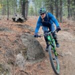
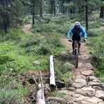
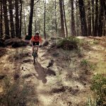
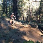
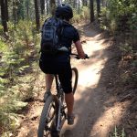
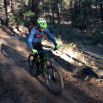
Lower Storm King starts at it’s lowest point at Forest Road 41 and soon crosses the new Catch and Release trail within the first 100 yards. The upper end the trail crosses Century Drive a few hundred yards East of the Green Gate trailhead where it becomes Upper Storm King.
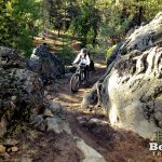
Storm King is a nice climbing route from Road 41 that never gets too steep, but lots of riders will shuttle from Wanoga via Tiddlywinks or Funner and ride down Storm King to their car, or back to town. There is a key intersection with Funner and Tiddly with a large rock outcropping you can’t miss.
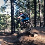
Heading down Lower Storm King to Rd 41, there’s only one short climb just after the Funner/Tiddly intersection before you reach a fast and twisty downhill section. Just before you get to Road 41 there are a series of small (and optional) table tops and doubles where you can catch a little air-time and just after Catch and Release is a nice G-out which adds to the fun factor.
Storm King was named in honor of the Prineville Hotshots who lost their lives on Storm King Mountain in Colorado in 1994. The trail was built by Leighton White.
This trail is maintained by Central Oregon Trail Alliance.




Closed due to Fire.
Down tree has been cleared. Thanks Don Leet. Only a couple small snow patches remain near tiddly intersection
Saturday, 5/14, from Noon to 1 PM the PPP mountain bike leg will have racers descending Lower Storm King down to Catch and Release. Please plan accordingly.
Puddles and pools of water the entire length of the trail. All drains are blocked. It would be best to avoid S.K. both upper and lower at this time. Its going to need a long time to drain out.
All dry and riding well.
From the Storm King/Upper Grand Slam junction it’s all rideable. All the way down to Catch and Release. Let’er RIP! Rode it on 4-15-21
Some snow close to the green gate and a few patches on the way down. A couple water crossings. Mostly rideable! Had a fun time today!
The couple trees were cleared yesterday.
4 water crossings, very refreshing. Trail is actually grippy and not blown out in the berms. Awesome.
No more snow, but the two mud bog spots are still there, one is still quite wet, the other is now fine to ride in the middle but has really been messed up by people riding around. Those 4 trees are all together in a cluster about half way up/down, right at the first little double jump.
Ran it this morning. Give lower Storm King (below Tiddly) a good week to dry out and finish melting. 4 trees (10″ or smaller) down on the upper half of this section. A couple of 40′ mud boggs, and a number of snowy sections. All the streams are running high.
How far are those trees in from green gate?
Packed snow today. Pretty much perfect fatbike conditions.
Riding great on the fatbike tonight. Nicely packed ribbon of snow with just a few short patches of frozen dirt. No ice, just grippy snow.
Should revise your description since the Century Drive crossing is now east of the green gate and there is no longer a spur trail.
Thanks Bruce. I just updated the Storm King text to reflect the recent COTA reroute.
Fairly obvious alternative lines being used between the four-way and the green gate.
Lower Storm King is in pretty bad shape. The mowing and logging equipment seems to have driven on the trail (and across the trail) in a lot of areas and there are spots that are really chewed up.
Tread didn’t seem all that different to me today. Forest a lot more open than it was, but I don’t find that a bad thing.
Brake bumps in the steeper turns, but not as dusty as I was expecting.
Hey Everyone! I was riding Tiddlywinks to Storm King on 6/12 and somehow my keys fell out of my pack. Please keep a lookout for a key chain with a Subaru key and 4 house keys on it. Thank you!
parking on colklin will be closed 6-7-18
The signs about the trail closure are gone and the ribbon is too. Lower, lower part — the straight away with the jumps is heavily chewed up by logging equipment. It’s ridable but it might need some rehab when they’re done.
As per DNF/DCFP/COTA: “Effective Wednesday, May 9, a section of Lower Storm King trail will be closed for logging and mastication efforts from junction 34 (Funner/Tiddly/SK jct) towards FS 41, with trail detour as follows: at jct 34, riders rerouted on short section of Tiddlywinks to power line road, tying back in to Storm King near FS 41.”
The West Bend map is not showing this closure as still being in effect. Seems like there is a plan to reroute Storm King’s crossing of the highway. When might that happen? What about the Green Gate access?
Thanks Bruce, when I was there the other day the trail closed signs had been taken down, so I’ve changed to the status to ‘Riding Well’ instead of ‘Closed’. Not sure about the re-route question, someone else will have to chime in on that.
To my knowledge trail is still closed above the Funner junction but if signs are gone then maybe it’s open? We rely on emails from the USFS and if they don’t say anything we don’t know anything.
As for the green gate area – last I heard the trail will be re-routed on the north side of the highway to come out near geeen gate and then green gate will be entrance to lower SK.
It’s now dry dry dry so might not be the best time to re-route this. Fall maybe.
Storm King is all open, rode it today. I hear the reroute to cross the highway will happen soon to allow better view of the traffic when crossing.
Confirmed. All open
There is a tree down 1.88 miles up from the Catch & Release Intersection. The lower Storm King Trail is open. Trail is dry.
How large is downed tree?
Tree is about 8″ in diameter
You magic trail loggers are fast. I rode it today and not a downed tree in sight.
The trail is only closed from the highway to the big intersection with Tiddly and Funner. We pedaled up the road and cut in at 4613. The rest of Storm king is in prime condition.
Just below Tiddly was super icy and many mud sections further down. Not really worth riding right now. 3-4 more dry days it should be ok I think.
Perfect on the fatbike today. 1” of snow at RD41 and maybe 5” in the upper meadow area.
Also, two trees down, one before the rocky stream crossing which you can ride under for now and one above the crossing that you have to walk around. Maybe 10-12″.
I took out those two trees today. Trail was really muddy and rutted with snowmelt flowing down the trail.
Lower Storm king is now closed from the junction with Funner/Tiddly up to the Cascade Lakes highway. Changing status to closed – but lower trail is actually not closed.
I think you meant “not closed”.
good catch. Fixed typo thanks
Awesome fatbiking conditions today. An inch or two of un-tracked fresh snow in the upper meadow and it was cold and still coming down hard around 3:00 pm. Tomorrow should be epic.
Rode Monday afternoon and encountered many wet spots, some that shouldn’t be ridden. With winter weather forecast, it may be a mute point, but Lower would be best not ridden til spring.
Rode this on Sunday and made it to the tiddlywinks intersection. It was about half good dirt, half rideable snow; still pretty fun.
One 12″ diameter tree down across the trail about .5 miles up from Conklin. Moved and cleared other storm debris.
Tree now clear
I rode up and down yesterday, and all is well. If you didn’t read this site, you’d never know the trail was damaged. Thanks to whomever cleaned it up!
The couple most definitely were on drugs that night. Very dehydrated when I ran into them. Apparently it was the man’s birthday…
Heads up, some fool drove his truck up most of lower Storm King. Mowing over at least a dozen small trees into the trail. Larger bolders were released and tire trenches were made. He finally got stuck for good and abandoned the truck just before the Funner junction. Is unsafe for decent at a normal speed. Equipment will be needed for tree removal and rehab. Awesome…
The cops were already involved but I have pics if anyone wants to “follow up” with this kook.
I gave water to that couple at about 945 AM today. They were in bad shape. Ridiculous.
Were the folks in the truck intoxicated? I cant imagine someone in their right mind thinking it was a good idea to take a truck up the trail. I am surprised they made it as far as they did.
Good grief. Email our pics to bendtrails@mtb-trails dot org and we can post about this.
All clear. Water still flowing at two crossings.
Down to one crossing as of yesterday. Still nice to see.
Riding great all the way to COD. Just a couple small snow sections that are all rideable, at least on the way up, but should be gone within a couple days. Several small creek crossings easy to go through.
3 trees cleared last night. Still some large sections of hike-a-bike snow near the funner/tiddly intersection. Other than that the trail is in great shape. 1 pretty large puddle where some logging equipment made a cut across the trail at one point, but no real mud. I think I counted 3 creek crossings. Upper section above intersection is clear all the way to Century of snow and no deadfall.
Road Lower SK Sunday three to four tress down (good size) Lots of patches of snow through out the trail. Many water crossing also, wet and or muddy sections. Probably another few weeks for this one
Snow fields start at the jump line towards the bottom. Not worth venturing this way yet.
Great for a fast uphill or downhill ride or warmup. Went there today after a mediocre ride out at Horse Butte. Current conditions for most routes west of Road 41 look really good due to recent light precipitation. Dirt is tacky with occasional muddy sections, but trail is still rideable without widening.
All clear from 41 to Larsen intersection with T-winks. Stream crossings are a bonus!
Rode yesterday.. two hike a bike sections leaving the tw funner intersection. . Couple rideable snow patches on the descent.. some down trees
3 to 4″ fresh heavy snow. Below that seemed mostly clear dirt but sections of deeper snow. This was the section from Century to Tiddlywinks. Below that probably clearer.